گلگت-بلتستان
گلگت-بلتستان (أردو: گِلگِت بَلتِسْتان، بالبالتية: རྒྱལ་སྐྱིད་ སྦལྟི་ཡུལ། ؛ [11] listen )، كانت تُعرف بالمناطق الشمالية،[12] هي منطقة إدارية تديرها پاكستان، وهي أقصى الكيانات السياسية شمالاً ضمن الجزء الذي تسيطر عليه باكستان من إمارة جامو وكشمير السابقة. ويحدها مقاطعة خيبر پختونخوا الباكستانية إلى الغرب، وممر وخان بأفغانستان إلى الشمال، والصين إلى الشمال الشرقي، والولاية التي تديرها باكستان أزاد جامو وكشمير (AJK) إلى الجنوب، وولاية جامو وكشمير التي تحتلها الهند إلى الجنوب الشرقي. المنطقة أصبحت وحدة ادارية منفردة في 1970 تحت اسم "المناطق الشمالية" وقد شـُكـِّلت بدمج وكالة گلگت ومقاطعة بلتستان من وزارة لدخ، وولايات هنزة ونگر. وعاصمتها الادارية هي بلدة گلگت، تغطي گلگت-بلتستان مساحة قدرها 72,971 كم² ويقرب تعدادها من 1,000,000 نسمة. وتعتبر پاكستان المنطقة منفصلة عن كشمير، بينما تعتبرها كل من الهند والاتحاد الاوروبي جزءاً من كشمير الكبرى التي تتنازعها الهند وباكستان منذ استقلالهما في 1947.[13][14] گلگت-بلتستان وأزاد كشمير تسميهما معاً الهند بإسم كشمير المحتلة من باكستان (PoK)، وبين الهند والصين منذ وقت لاحق.[15] It borders Azad Kashmir to the south, the province of Khyber Pakhtunkhwa to the west, the Wakhan Corridor of Afghanistan to the north, the Xinjiang region of China, to the east and northeast, and the Indian-administered union territories Jammu and Kashmir and Ladakh to the southeast.
گلگت-بلتستان
گِلگِت بَلتِستان རྒྱལ་སྐྱིད་ སྦལྟི་ཡུལ། | |
|---|---|
منطقة تديرها پاكستان باعتبارها منطقة إدارية [1] | |
  | |
 خريطة لمنطقة كشمير المتنازع عليها توضح موقع منطقة گلگت-بلتستان. | |
| الإحداثيات: 35°21′N 75°54′E / 35.35°N 75.9°ECoordinates: 35°21′N 75°54′E / 35.35°N 75.9°E | |
| البلد | پاكستان |
| تأسست | 1 نوفمبر 1948 |
| العاصمة | گلگت |
| أكبر مدينة | سكردو[2] |
| الحكومة | |
| • النوع | منطقة حكم ذاتي پاكستانية |
| • الكيان | حكومة گلگت-بلتستان |
| • الحاكم | راجا جلال حسين مگپون |
| • كبير الوزراء | مير أفضل |
| • كبير الأمناء | محمد خرم أغا [3] |
| • المجلس التشريعي | المجلس التشريعي |
| • المحكمة العليا | محكمة گلگت-بلتستان العليا [4] |
| المساحة | |
| • الإجمالي | 72٬971 كم² (28٬174 ميل²) |
| [5] | |
| التعداد | |
| • الإجمالي | 1٫249٫000 |
| • الكثافة | 0/km2 (0/sq mi) |
| منطقة التوقيت | UTC+05:00 (PST) |
| ISO 3166 code | PK-GB |
| اللغات | البالتي، الشينا، الواخي، البورشاسكي، الخوار، الأردو (ادارياً) |
| م.ت.ب. (2018) | 0.593 ▲[8] متوسط |
| مقاعد المجلس | 33[9] |
| التقسيمات | 3 |
| الضلوع | 14[10] |
| التحصيلات | 28[بحاجة لمصدر] |
| الموقع الإلكتروني | gilgitbaltistan |
The region, together with Azad Kashmir in the southwest, is grouped and referred to by the United Nations and other international organisations as "Pakistan-administered Kashmir".[note 1] Gilgit-Baltistan is six times larger than Azad Kashmir in terms of geographical area.[20]
The territory of present-day Gilgit-Baltistan became a separate administrative unit in 1970 under the name "Northern Areas". It was formed by the amalgamation of the former Gilgit Agency, the Baltistan district, and several small former princely states, the largest of which were Hunza and Nagar.[21] In 2009, the region was renamed to "Gilgit-Baltistan" and granted limited autonomy through the Self-Governance Order signed in by former Pakistani president Asif Ali Zardari, a move that was reportedly intended to also empower the territory's people; however, scholars state that the real power rests with the governor and not with the chief minister or elected assembly.[22][23] Much of the population of Gilgit-Baltistan reportedly wants the territory to become integrated with Pakistan proper as a fifth province, and opposes integration with the rest of the Kashmir region.[24][25] The Pakistani government had rejected calls from the territory for provincial status on the grounds that granting such a request would jeopardise Pakistan's demands for the entire Kashmir conflict to be resolved according to all related United Nations resolutions.[26] However, in November 2020, Pakistani prime minister Imran Khan announced that Gilgit-Baltistan would attain provisional provincial status after the 2020 Gilgit-Baltistan Assembly election.[27][28][29]
Gilgit-Baltistan covers an area of over 72,971 km2 (28,174 sq mi)[5] and is highly mountainous. It had an estimated population of 1.249 million people in 2013[6][7] (estimated to be 1.8 million in 2015 (Shahid Javed Burki (2015)). Its capital city is Gilgit with an estimated population of 216,760. It's economy is dominated by agriculture and the tourism industry. [30]The region is home to five of the 14 eight-thousanders, including K2, and additionally has more than fifty mountain peaks above 7,000 metres (23,000 ft). Three of the world's longest glaciers outside of Earth's polar regions are found in Gilgit-Baltistan. The main tourism activities are trekking and mountaineering, and this industry has been growing in importance throughout the region.
. . . . . . . . . . . . . . . . . . . . . . . . . . . . . . . . . . . . . . . . . . . . . . . . . . . . . . . . . . . . . . . . . . . . . . . . . . . . . . . . . . . . . . . . . . . . . . . . . . . . . . . . . . . . . . . . . . . . . . . . . . . . . . . . . . . . . . . . . . . . . . . . . . . . . . . . . . . . . . . . . . . . . . . .
التاريخ المبكر

The rock carvings found in various places in Gilgit-Baltistan, especially in the Passu village of Hunza, suggest a human presence since 2000 BC.[32] Within the next few centuries of human settlement on the Tibetan plateau, this region became inhabited by Tibetans, who preceded the Balti people of Baltistan. Today Baltistan bears similarity to Ladakh physically and culturally (although not in religion). Dards are found mainly in the western areas. These people are the Shina-speaking peoples of Gilgit, Chilas, Astore and Diamir, while in Hunza and the upper regions, Burushaski and Khowar speakers predominate. The Dards find mention in the works of Herodotus,[note 2] Nearchus, Megasthenes, Pliny,[note 3] Ptolemy,[note 4] and the geographical lists of the Puranas.[33] In the 1st century, the people of these regions were followers of the Bon religion while in the 2nd century, they practiced Buddhism.
Between 399 and 414, the Chinese Buddhist pilgrim Faxian visited Gilgit-Baltistan.[34] In the 6th century Somana Palola (greater Gilgit-Chilas) was ruled by an unknown king. Between 627 and 645, the Chinese Buddhist pilgrim Xuanzang travelled through this region on his pilgrimage to India.
According to Chinese records from the Tang dynasty, between the 600s and the 700s, the region was governed by a Buddhist dynasty referred to as Bolü (صينية: 勃律؛ پنين: bólǜ�), also transliterated as Palola, Patola, Balur.[35] They are believed to have been the Patola Shahis dynasty mentioned in a Brahmi inscription,[36] and devout adherents of Vajrayana Buddhism.[37] At the time, Little Palola (صينية: 小勃律) was used to refer to Gilgit, while Great Palola (صينية: 大勃律) was used to refer to Baltistan. However, the records do not consistently disambiguate the two.

In mid-600s, Gilgit came under Chinese suzerainty after the fall of the Western Turkic Khaganate to Tang military campaigns in the region. In the late 600s CE, the rising Tibetan Empire wrestled control of the region from the Chinese. However, faced with growing influence of the Umayyad Caliphate and then the Abbasid Caliphate to the west, the Tibetans were forced to ally themselves with the Islamic caliphates. The region was then contested by Chinese and Tibetan forces, and their respective vassal states, until the mid-700s.[38] Rulers of Gilgit formed an alliance with the Tang Chinese, and held back the Arabs with their help.[39]
Between 644 and 655, Navasurendrāditya-nandin became king of the Palola Sāhi dynasty in Gilgit.[40] Numerous Sanskrit inscriptions, including the Danyor Rock Inscriptions, were discovered to be from his reign.[41] In the late 600s and early 700s, Jayamaṅgalavikramāditya-nandin was king of Gilgit.[40]
According to Chinese court records, in 717 and 719 respectively, delegations of a ruler of Great Palola (Baltistan) named Su-fu-she-li-ji-li-ni (صينية: 蘇弗舍利支離泥؛ پنين: sūfúshèlìzhīlíní�) reached the Chinese imperial court.[42][43] By at least 719/720, Ladakh (Mard) became part of the Tibetan Empire. By that time, Buddhism was practised in Baltistan, and Sanskrit was the written language.
In 720, the delegation of Surendrāditya (صينية: 蘇麟陀逸之؛ پنين: sūlíntuóyìzhī�) reached the Chinese imperial court. He was referred to in Chinese records as the king of Great Palola; however, it is unknown if Baltistan was under Gilgit rule at the time.[44] The Chinese emperor also granted the ruler of Cashmere, Chandrāpīḍa ("Tchen-fo-lo-pi-li"), the title of "King of Cashmere". By 721/722, Baltistan had come under the influence of the Tibetan Empire.[45]
In 721–722, the Tibetan army attempted but failed to capture Gilgit or Bruzha (Yasin valley). By this time, according to Chinese records, the king of Little Palola was Mo-ching-mang (صينية: 沒謹忙؛ پنين: méijǐnmáng�). He had visited the Tang court requesting military assistance against the Tibetans.[44] Between 723 and 728, the Korean Buddhist pilgrim Hyecho passed through this area. In 737/738, Tibetan troops under the leadership of Minister Bel Kyesang Dongtsab of Emperor Me Agtsom took control of Little Palola. By 747, the Chinese army under the leadership of the ethnic-Korean commander Gao Xianzhi had recaptured Little Palola.[46] Great Palola was subsequently captured by the Chinese army in 753 under military Governor Feng Changqing. However, by 755, due to the An Lushan rebellion, the Tang Chinese forces withdrew and were no longer able to exert influence in Central Asia or in the regions around Gilgit-Baltistan.[47] The control of the region was left to the Tibetan Empire. They referred to the region as Bruzha, a toponym that is consistent with the ethnonym "Burusho" used today. Tibetan control of the region lasted until late-800s CE.[48]
Turkic tribes practising Zoroastrianism arrived in Gilgit during the 7th century, and founded the Trakhan dynasty in Gilgit.[39]
التاريخ الوسيط
In the 14th century, Sufi Muslim preachers from Persia and Central Asia introduced Islam in Baltistan. Famous amongst them was Mir Sayyid Ali Hamadani, who came through Kashmir[49] while in the Gilgit region Islam entered in the same century through Turkic Tarkhan rulers. Gilgit-Baltistan was ruled by many local rulers, amongst whom the Maqpon dynasty of Skardu and the Rajas of Hunza were famous. The Maqpons of Skardu unified Gilgit-Baltistan with Chitral and Ladakh, especially in the era of Ali Sher Khan Anchan[50] who had friendly relations with the Mughal court.[51] Anchan's reign brought prosperity and entertained art, sport, and variety in architecture. He introduced polo to the Gilgit region, and sent a group of musicians from Chitral to Delhi to learn Indian music; Mughal architecture influenced the architecture of the region as well under his reign.[52] Later Anchan in his successors Abdal Khan had great influence though in the popular literature of Baltistan, where he is still alive as a dark figure by the nickname "Mizos", "man-eater". The last Maqpon Raja, Ahmed Shah, ruled all of Baltistan between 1811 and 1840. The areas of Gilgit, Chitral and Hunza had already become independent of the Maqpons.[بحاجة لمصدر]
Before the demise of Shribadat, a group of Shina people migrated from Gilgit Dardistan and settled in the Dras and Kharmang areas. The descendants of those Dardic people can be still found today, and are believed to have maintained their Dardic culture and Shina language up to the present time.[بحاجة لمصدر]


| الحيوان | الياك[53][54] | 
|
|---|---|---|
| الطائر | العقاب الذهبي[53][54] | 
|
| الشجرة | المشمش[53][54] | 
|
| الزهرة | زهرة الحوض | 
|
| الرياضة | الپولو |
التاريخ الحديث
الولاية الأميرية جمو وكشمير: حكم الدوگرا

.jpg)
In November 1839, Dogra commander Zorawar Singh, whose allegiance was to Gulab Singh, started his campaign against Baltistan.[56] By 1840 he conquered Skardu and captured its ruler, Ahmad Shah. Ahmad Shah was then forced to accompany Zorawar Singh on his raid into Western Tibet. Meanwhile, Baghwan Singh was appointed as administrator (thanadar) in Skardu. But in the following year, Ali Khan of Rondu, Haidar Khan of Shigar and Daulat Ali Khan from Khaplu led a successful uprising against the Dogras in Baltistan and captured the Dogra commander Baghwan Singh in Skardu.[57]
In 1842, Dogra Commander Wasir Lakhpat, with the active support of Ali Sher Khan (III) from Kartaksho, conquered Baltistan for the second time. There was a violent capture of the fortress of Kharphocho. Haidar Khan from Shigar, one of the leaders of the uprising against the Dogras,[58] was imprisoned and died in captivity. Gosaun was appointed as administrator (Thanadar) of Baltistan and till 1860, the entire region of Gilgit-Baltistan was under the Sikhs and then the Dogras.[59][60]
After the defeat of the Sikhs in the First Anglo-Sikh War, the region became a part of the Jammu and Kashmir princely state, which since 1846 had remained under the rule of the Dogras. The population in Gilgit perceived itself as ethnically different from Kashmiris and disliked being ruled by the Kashmir state.[61] The region remained with the princely state, with temporary leases of some areas assigned to the British, until 1 November 1947.
حرب كشمير الأولى
تحت الإدارة الپاكستانية
_unveils_the_updated_official_map_of_the_country_in_August_2020._Photo_credit_EPA.jpg)
في نهاية سبتمبر 2020، أعلنت پاكستان تعلن ضم گلگت-بلتستان الكشميرية لتصبح الإقليم الخامس بالدولة. رئيس الوزراء عمران خان أعلن القرار وأصدر مرسوماً بإجراء استفتاء، في الإقليم، على الضم سيجري هذا الشهر أكتوبر 2020.[62]
وقد احتجت الهند بقوة على القرار، لأنها تطالب بالإقليم كجزء من جمو وكشمير التي أعلنت في 2019 ضم الجزء الذي كان تحت ادارتها منذ تقسيم الهند في 1947.[63]
قرار الضم جاء عقب عودة عمران خان من زيارة للصين. ويـُعتقد أن الصين هي من حثت پاكستان على الضم، خاصة مع تصاعد المواجهات العسكرية الصينية الهندية في إقليم لداخ الكشميري الملاصق لگلگت-بلتستان.[64] ومن المتوقع أن تتصاعد المواجهات الصينية الهندية في شهر أكتوبر 2020 الحالي قبل الانتخابات الرئاسية الأمريكية في 3 نوفمبر 2020.
الحكومة
. . . . . . . . . . . . . . . . . . . . . . . . . . . . . . . . . . . . . . . . . . . . . . . . . . . . . . . . . . . . . . . . . . . . . . . . . . . . . . . . . . . . . . . . . . . . . . . . . . . . . . . . . . . . . . . . . . . . . . . . . . . . . . . . . . . . . . . . . . . . . . . . . . . . . . . . . . . . . . . . . . . . . . . .
التقسيمات الإدارية


Gilgit-Baltistan is administratively divided into three divisions: Baltistan, Diamer and Gilgit,[65] which, in turn, are divided into fourteen districts. المراكز الإدارية الرئيسية هم بلدتي گلگت و سكردو.
| القسم | الضلع | المساحة (كم²) | العاصمة | Population (2013)[66] | عاصمة القسم |
|---|---|---|---|---|---|
| بلتستان | گانچهى | 4,052 | خپلو | 108,000 | سكردو |
| Shigar | 8,500 | Shigar | - | ||
| Kharmang | 5,500 | Kharmang | - | ||
| سكرد | 8,700 | سكردو | 305,000* | ||
| Roundu | NA | Dambudas | NA | ||
| گلگت | گلگت | 14,672 | گلگت | 222,000 | گلگت |
| Ghizer | 9,635 | Gahkuch | 190,000 | ||
| هنزة | 7,900 | علي آباد | 70,000 (2015)[67] | ||
| Nagar | 5,000 | Nagar | 51,387 (1998)[66] | ||
| Gupis–Yasin | NA | Phander? | NA | ||
| ديامر | ديامر | 10,936 | چلاس | 214,000 | چلاس |
| Astore | 5,092 | عيد گاه | 114,000 | ||
| Darel | NA | داريل | NA | ||
| Tangir | NA | Tangir | NA |
* Combined population of Skardu, Shigar, Kharmang and Roundu districts. Shigar and Kharmang Districts were carved out of Skardu District after 1998. The estimated population of Gilgit-Baltistan was about 1.8 million in 2015[21] and the overall population growth rate between 1998 and 2011 was 63.1% making it 4.85% annually.[68][69]
الجغرافيا


يتاخم گلگت-بلتستان ممر وخان في أفغانستان من الشمال الغربي، ومنطقة الاويغور ذاتية الحكم في شينجيانگ الصينية من الشمال الشرقي، وولاية جامو وكشمير التي تحتلها الهند من الجنوب والجنوب الشرقي، وولاية أزاد جامو وكشمير التي تسيطر عليها باكستان إلى الجنوب، إقليم التخوم الشمالية الغربية الباكستاني من الغرب.
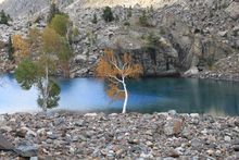
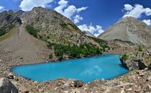
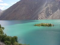
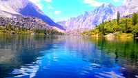
ثلاثة من أطول المثلجات في العالم خارج المناطق القطبية توجد في گلگت-بلتستان — the Biafo Glacier, the Baltoro Glacier, and the Batura Glacier. وبالاضافة لذلك يوجد عدة بحيرات عالية الارتفاع في گلگت-بلتستان:
- Sheosar Lake in Deosai Plains - Astore region
- Satpara Tso Lake in Skardu - بلتستان
- Katzura Tso Lake in Skardu - بلتستان
- Zharba Tso Lake in Shigar - بلتستان
- Phoroq Tso Lake in Skardu - بلتستان
- Bara Tso Lake in Gangche - بلتستان
- Byarsa Tso Lake in Gultari - بلتستان
- Borith Lake in upper Hunza - Gilgit
- Rama Lake near Astore
- Rush Lake near Nagar - Gilgit
- Kromber Lake In Kromber Pass - Gilgit
Satpara Lake, Skardu, in 2002
Upper Kachura Lake
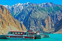
A boat in Attabad Lake
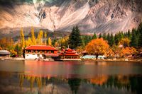
Shangrila Lake, Skardu


المناخ


The climate of Gilgit-Baltistan varies from region to region, since the surrounding mountain ranges create sharp variations in weather. The eastern part has the moist zone of the western Himalayas, but going toward Karakoram and Hindu Kush, the climate gets considerably drier.[71]
There are towns like Gilgit and Chilas that are very hot during the day in summer yet cold at night and valleys like Astore, Khaplu, Yasin, Hunza, and Nagar, where the temperatures are cold even in summer.[72]
آثار التغير المناخي
Climate change has adversely effected this region with more rains every year. On 26 August 2022, most villages in Ghizer district and Hunza were severely effected by the ongoing flooding displacing many people.
الاقتصاد والموارد

The economy of the region is primarily based on a traditional trade route, the historic Silk Road. The China Trade Organization forum led the people of the area to actively invest and learn modern trade know-how from their Chinese neighbour, Xinjiang.[بحاجة لمصدر] Later, the establishment of a chamber of commerce and the Sust dry port in Gojal Hunza are milestones. The rest of the economy is shouldered by mainly agriculture and tourism. Agricultural products are wheat, corn (maize), barley, and fruits. Tourism is mostly in trekking and mountaineering, and this industry is growing in importance.[73][74]
In early September 2009, Pakistan signed an agreement with the People's Republic of China for a major energy project in Gilgit-Baltistan which includes the construction of a 7,000-megawatt dam at Bunji in the Astore District.[75]
تسلق الجبال


| اسم القمة | صور | الارتفاع | أول تسلق | الموقع |
|---|---|---|---|---|
| 1.K-2 | |
(28,250Ft) | 31 Jul 1954 | Karakoram |
| 2. Nanga Parbat |  |
(26,660 Ft) | 3 Jul 1953 | Himalaya |
| 3. Gasherbrum I |  |
(26,360Ft) | 7 Jul 1956 | Karakoram |
| 4. Broad Peak |  |
(26,550Ft) | 9 Jun 1957 | Karakoram |
| 5. Muztagh Tower |  |
(23,800Ft) | 6 Aug 1956 | Karakoram |
| 6. Gasherbrum II |
|
(26,120Ft) | 4 Jul 1958 | Karakoram |
| 7. Hidden Peak |  |
(26,470Ft) | 4 Jul 1957 | Karakoram |
| 8. Khunyang Chhish |  |
(25,761 Ft) | 4 July 1971 | Karakoram |
| 9. Masherbrum |  |
(25,659 Ft) | 4 Aug 1960 | Karakoram |
| 10. Saltoro Kangri |  |
(25,400Ft) | 4 June 1962 | Karakoram |
| 11. Chogolisa | 
|
(25,148 Ft) | 4 Aug 1963 | Karakoram |
. . . . . . . . . . . . . . . . . . . . . . . . . . . . . . . . . . . . . . . . . . . . . . . . . . . . . . . . . . . . . . . . . . . . . . . . . . . . . . . . . . . . . . . . . . . . . . . . . . . . . . . . . . . . . . . . . . . . . . . . . . . . . . . . . . . . . . . . . . . . . . . . . . . . . . . . . . . . . . . . . . . . . . . .
السياحة


النقل


الديموغرافيا
اللغات
| الترتيب | اللغة | تفاصيل[77][78][79][80][81][82][83][84] |
|---|---|---|
| 1 | الشينا | It is a Dardic language spoken by the majority in six tehsils (Gilgit, Diamir/Chilas, Darel/Tangir, Astore, Puniyal/Gahkuch and Rondu). |
| 2 | البالتي | It is spoken by the majority in five tehsils (Skardu/Shigar, Kharmang, Gultari, Khaplu and Mashabrum). It is from the Tibetan language family and has Urdu borrowings. |
| 3 | البوروشاسكي | It is spoken by the majority in four tehsils (Nagar 1, Hunza/Aliabad, Nagar II, and Yasin). It is a language isolate that has borrowed considerable Urdu vocabulary. |
| 4 | الخوار | It is spoken by the majority in two tehsils (Gupis and Ishkomen) but also spoken in Yasin and Puniyal/Gahkuch Tehsils. Like Shina, it is a Dardic language. |
| 5 | الواخي | It is spoken by the majority of people in Gojal Tehsil of Hunza. But it is also spoken in Ishkomen and Yasin Tehsils of District Ghizer. It is classified as eastern Iranian/ Pamiri language. |
| أخرى | Pashto, Kashmiri, Domaaki (spoken by musician clans in the region) and Gojri languages are also spoken by a significant population of the region. |
الديانات
الثقافة


الرياضة

انظر أيضاً
الهوامش
- ^ The Indian government and Indian sources refer to Azad Kashmir and Gilgit-Baltistan as "Pakistan-occupied Kashmir" ("PoK")[16] or "Pakistan-held Kashmir" ("PhK").[17] Sometimes Azad Kashmir alone is meant by these terms.[16] "Pakistan-administered Kashmir" and "Pakistan-controlled Kashmir"[18][19] are used by neutral sources. Conversely, Pakistani sources refer to the territories under Indian control as "Indian-occupied Kashmir" ("IoK") or "Indian-held Kashmir" ("IhK").[16]
- ^ He twice mentions a people called Dadikai, first along with the Gandarioi, and again in the catalogue of king Xerxes's army invading Greece. Herodotus also mentions the gold-digging ants of Central Asia.
- ^ In the 1st century, Pliny repeats that the Dards were great producers of gold.
- ^ Ptolemy situates the Daradrai on the upper reaches of the Indus
المصادر
- ^ خطأ استشهاد: وسم
<ref>غير صحيح؛ لا نص تم توفيره للمراجع المسماةWeightman - ^ "Skardu". Skardu. Retrieved 16 July 2015.
- ^ "Khuram Aga posted chief secretary GB". TheNation. Retrieved 12 March 2020.
- ^ [1]
- ^ أ ب "UNPO: Gilgit Baltistan: Impact Of Climate Change On Biodiversity". unpo.org. Retrieved 20 June 2016.
- ^ أ ب Geography & Demography of Gilgit Baltistan, Gilgit Baltistan Scouts, retrieved 30 March 2020. خطأ استشهاد: وسم
<ref>غير صالح؛ الاسم "Scouts" معرف أكثر من مرة بمحتويات مختلفة. - ^ أ ب Under Pakistan Rule, Gilgit-Baltistan Most Neglected, Backward Area in South Asia, Says New Book, News18, 18 August 2019.
- ^ "Sub-national HDI - Area Database - Global Data Lab". hdi.globaldatalab.org (in الإنجليزية). Retrieved 2020-03-15.
- ^ Legislative Assembly will have directly elected 24 members, besides six women and three technocrats. "Gilgit Baltistan: New Pakistani Package or Governor Rule" 3 September 2009, The Unrepresented Nations and Peoples Organization (UNPO)
- ^ خطأ استشهاد: وسم
<ref>غير صحيح؛ لا نص تم توفيره للمراجع المسماةPT2019 - ^ "گلگت بلتستان اسمبلی کادوسرا اجلاس". Gilgit-Baltistan Assembly (in الأوردية). 19 December 2020. Retrieved 16 February 2021.
- ^ Hinman, Bonnie (15 September 2011), We Visit Pakistan, Mitchell Lane Publishers, Inc., p. 41, ISBN 978-1-61228-103-2, https://books.google.com/books?id=kbyXBgAAQBAJ&pg=PA41
- ^ "15451". Meaindia.nic.in. 2010-01-01. Retrieved 2010-06-05.
- ^ "India gets European Parliament support - New Europe". Neurope.eu. 2007-06-01. Retrieved 2010-06-05.
- ^ تطبيق المصطلح "administered" to the various regions of Kashmir and a mention of the Kashmir dispute is supported by the tertiary sources (a) through (d), reflecting due weight in the coverage. Although "controlled" and "held" are also applied neutrally to the names of the disputants or to the regions administered by them, as evidenced in sources (e) through (g) below, "held" is also considered politicized usage, as is the term "occupied," (see (h) below):
(a) Kashmir, region Indian subcontinent. Encyclopaedia Britannica. Retrieved 15 August 2019. (subscription required) Quote: "Kashmir, region of the northwestern Indian subcontinent ... has been the subject of dispute between India and Pakistan since the partition of the Indian subcontinent in 1947. The northern and western portions are administered by Pakistan and comprise three areas: Azad Kashmir, Gilgit, and Baltistan, the last two being part of a territory called the Northern Areas. Administered by India are the southern and southeastern portions, which constitute the state of Jammu and Kashmir but are slated to be split into two union territories.";
(b) Pletcher, Kenneth, Aksai Chin, Plateau Region, Asia, Encyclopaedia Britannica, https://www.britannica.com/place/Aksai-Chin, retrieved on 16 August 2019 (subscription required) Quote: "Aksai Chin, Chinese (Pinyin) Aksayqin, portion of the Kashmir region, at the northernmost extent of the Indian subcontinent in south-central Asia. It constitutes nearly all the territory of the Chinese-administered sector of Kashmir that is claimed by India to be part of the Ladakh area of Jammu and Kashmir state.";
(c) "Kashmir", Encyclopedia Americana, Scholastic Library Publishing, 2006, p. 328, ISBN 978-0-7172-0139-6 C. E Bosworth, University of Manchester Quote: "KASHMIR, kash'mer, the northernmost region of the Indian subcontinent, administered partlv by India, partly by Pakistan, and partly by China. The region has been the subject of a bitter dispute between India and Pakistan since they became independent in 1947";
(d) Talbot, Ian (2016), A History of Modern South Asia: Politics, States, Diasporas, Yale University Press, pp. 28–29, ISBN 978-0-300-19694-8, https://books.google.com/books?id=eNg_CwAAQBAJ&pg=PA28 Quote: "We move from a disputed international border to a dotted line on the map that represents a military border not recognized in international law. The line of control separates the Indian and Pakistani administered areas of the former Princely State of Jammu and Kashmir.";
(e) Kashmir, region Indian subcontinent, Encyclopaedia Britannica, https://www.britannica.com/place/Kashmir-region-Indian-subcontinent, retrieved on 15 August 2019 (subscription required) Quote: "... China became active in the eastern area of Kashmir in the 1950s and has controlled the northeastern part of Ladakh (the easternmost portion of the region) since 1962.";
(f) Bose, Sumantra (2009), Kashmir: Roots of Conflict, Paths to Peace, Harvard University Press, pp. 294, 291, 293, ISBN 978-0-674-02855-5, https://books.google.com/books?id=3ACMe9WBdNAC&pg=PA294 Quote: "J&K: Jammu and Kashmir. The former princely state that is the subject of the Kashmir dispute. Besides IJK (Indian-controlled Jammu and Kashmir. The larger and more populous part of the former princely state. It has a population of slightly over 10 million, and comprises three regions: Kashmir Valley, Jammu, and Ladakh.) and AJK ('Azad" (Free) Jammu and Kashmir. The more populous part of Pakistani-controlled J&K, with a population of approximately 2.5 million. AJK has six districts: Muzaffarabad, Mirpur, Bagh, Kodi, Rawalakot, and Poonch. Its capital is the town of Muzaffarabad. AJK has its own institutions, but its political life is heavily controlled by Pakistani authorities, especially the military), it includes the sparsely populated "Northern Areas" of Gilgit and Baltistan, remote mountainous regions which are directly administered, unlike AJK, by the Pakistani central authorities, and some high-altitude uninhabitable tracts under Chinese control."
(g) Fisher, Michael H. (2018), An Environmental History of India: From Earliest Times to the Twenty-First Century, Cambridge University Press, p. 166, ISBN 978-1-107-11162-2, https://books.google.com/books?id=kZVuDwAAQBAJ&pg=PA166 Quote: "Kashmir's identity remains hotly disputed with a UN-supervised "Line of Control" still separating Pakistani-held Azad ("Free") Kashmir from Indian-held Kashmir.";
(h) Snedden, Christopher (2015), Understanding Kashmir and Kashmiris, Oxford University Press, p. 10, ISBN 978-1-84904-621-3, https://books.google.com/books?id=5amKCwAAQBAJ&pg=PA10 Quote:"Some politicised terms also are used to describe parts of J&K. These terms include the words 'occupied' and 'held'." - ^ أ ب ت Snedden 2013, pp. 2–3.
- ^ Chandra, Bipan; Mukherjee, Aditya; Mukherje, Mridula (2008). India since Independence. Penguin Books India. p. 416. ISBN 978-0143104094.
- ^ Bose, Sumantra (2009). Contested lands: Israel-Palestine, Kashmir, Bosnia, Cyprus and Sri Lanka. Harvard University Press. p. 193. ISBN 978-0674028562.
- ^ Behera 2007, p. 66.
- ^ Dutta, Prabhash K. (25 March 2017). "Gilgit-Baltistan: Story of how region 6 times the size of PoK passed on to Pakistan". India Today.
- ^ أ ب Shahid Javed Burki 2015.
- ^ In Pakistan-controlled Kashmir, residents see experiment with autonomy as 'illusion', Christian Science Monitor, 28 November 2011
- ^ Sering, Senge H. (2010), "Constitutional Impasse in Gilgit-Baltistan (Jammu and Kashmir): The Fallout", Strategic Analysis 34 (3): 354–358, doi:, "Instead of the chief minister, the order rests all administrative, political and judicial authority with the governor, which makes him the supreme authority and portrays the assembly as a toothless tiger. At best, the order legitimises Pakistan's occupation and claims political rights for the locals without changing the power equation."
- ^ خطأ استشهاد: وسم
<ref>غير صحيح؛ لا نص تم توفيره للمراجع المسماة:0 - ^ خطأ استشهاد: وسم
<ref>غير صحيح؛ لا نص تم توفيره للمراجع المسماة:1 - ^ خطأ استشهاد: وسم
<ref>غير صحيح؛ لا نص تم توفيره للمراجع المسماةSchofield - ^ "Fifth province". Fifth province | The Express Tribune. The Express Tribune. 2 November 2020. Archived from the original on 9 November 2020. Retrieved 14 November 2020.
- ^ "Pakistani PM says he will upgrade status of part of Kashmir, angering India". Pakistani PM says he will upgrade status of part of Kashmir, angering India | Reuters. Reuters. 1 November 2020. Archived from the original on 2 November 2020. Retrieved 14 November 2020.
- ^ "Gilgit-Baltistan to get provisional provincial status post-election: PM Imran". Gilgit-Baltistan to get provisional provincial status post-election: PM Imran. The News International. 2 November 2020. Retrieved 14 November 2020.
- ^ Paracha, Nadeem F. (2016-12-22). "Here is why Pakistan is more diverse than you thought". DAWN.COM (in الإنجليزية). Retrieved 2023-01-31.
- ^ أ ب ت "Episode 1: A Window to Gilgit-Baltistan". خطأ استشهاد: وسم
<ref>غير صالح؛ الاسم "windowtogb.blogspot.it" معرف أكثر من مرة بمحتويات مختلفة. - ^ By Ian Hibbert (17 November 2015). Alpamayo to Everest: It's Not About the Summit. ISBN 9781483440736.
- ^ Petech, Luciano (1977). The Kingdom of Ladakh c. 950–1842 A.D. Istituto Italiano per il media ed Estremo Oriente.
- ^ By Rafi U. Samad (2011). The Grandeur of Gandhara: The Ancient Buddhist Civilization of the Swat ... ISBN 9780875868592.
- ^ Sen, Tansen (2015). Buddhism, Diplomacy, and Trade: The Realignment of India–China Relations, 600–1400. Rowman & Littlefield. ISBN 9781442254732. Retrieved 19 February 2017.
- ^ Schmidt, Ruth Laila; Kohistani, Razwal (2008). A Grammar of the Shina Language of Indus Kohistan. ISBN 978-3447056762. Retrieved 23 January 2018.
- ^ Twist, Rebecca L. (2007). Patronage, Devotion and Politics: A Buddhological Study of the Patola Sahi Dynasty's Visual Record. Ohio State University. ISBN 9783639151718. Retrieved 19 February 2017.
- ^ Stein, Mark Aurel (1907). Ancient Khotan: Detailed Report of Archaeological Explorations in Chinese Turkestan. Vol. 1. Oxford, UK: Clarendon Press. pp. 4–18.
- ^ أ ب Bradnock, Robert W. (1994). South Asian Handbook. Trade & Travel Publications. p. 1168.
- ^ أ ب Neelis, Jason (2011). Early Buddhist Transmission and Trade Networks. p. 177. ISBN 9789004181595. Archived from the original on 22 February 2018. Retrieved 21 February 2018.
{{cite book}}:|work=ignored (help) - ^
Stein, Aurel (2011). "Archæological Notes form the Hindukush Region". Journal of the Royal Asiatic Society of Great Britain & Ireland. 76 (1–2): 5–24. doi:10.1017/S0035869X00098713. ISSN 0035-869X. S2CID 163127705.
Sri-Nava-Surendraditya-Nandideva
- ^ "Baltistan". Tibetan Encyclopedia.
- ^
 全唐文 on Wikisource
- ^ أ ب
- 新唐書 on Wikisource
- ^ Francke, August Hermann (1992). Antiquities of Indian Tibet, Part 1. ISBN 9788120607699.
- ^ Grousset, René (1952). The Rise and Splendour of the Chinese Empire. p. 160.
- ^ By Angela Falco Howard (2006). Chinese Sculpture. p. 313. ISBN 978-0300100655.
- ^ Mock, John (October 2013). "A Tibetan Toponym from Afghanistan" (PDF). Revue d'Études Tibétaines (27): 5–9. ISSN 1768-2959. Retrieved 22 January 2018.
- ^ By Henry Osmaston, Philip Denwood (1995). Recent Research on Ladakh 4 & 5: Proceedings of the Fourth and Fifth ... ISBN 9788120814042.
- ^ P. Stobdan (April 2008). The last colony: Muzaffarabad-Gilgit-Baltistan. ISBN 9788183860673.
- ^ International Council on Archives, National Archives of Pakistan (1990). Guide to the Sources of Asian History: National archives, Provincial archives, District archives. ISBN 9789698156022.
- ^ Philippe Fabry, Yousuf Shahid (1995). Wandering with the Indus. ISBN 9789690102249.
- ^ أ ب ت "Symbols of Gilgit-Baltistan". knowpakistan.gov.in. Retrieved 14 August 2013.[dead link]
- ^ أ ب ت "Gilgit-Baltistan Key Indicators" (PDF). Retrieved 14 August 2013.[dead link]
- ^ Francke, August Hermann (1907), A History of Western Tibet: One of the Unknown Empires, Asian Educational Services, pp. 164–, ISBN 978-81-206-1043-9, https://books.google.com/books?id=w4zFRTmiXtkC&pg=PA164
- ^ By S.R. Bakshi (1997). Kashmir: History and People. Sarup & Sons. p. 158. ISBN 9788185431963.
- ^ By Sanjeev Kumar Bhasi (2006). Amazing Land Ladakh: Places, People, and Culture. ISBN 9788173871863.
- ^ By Shridhar Kaul, H. N. Kaul (1992). Ladakh Through the Ages, Towards a New Identity. ISBN 9788185182759.
- ^ Bubandt, Nils Ole; Beek, Martijn Van (12 March 2012). Varieties of Secularism in Asia: Anthropological Explorations of Religion, Politics and the Spiritual. Routledge. ISBN 9781136668647 – via Google Books.
- ^ By Peter Berger, Frank Heidemann (3 June 2013). The Modern Anthropology of India: Ethnography, Themes and Theory. ISBN 978-1134061112.
- ^ Bangash 2010, pp. 125–126.
- ^ تغريد من تلفزيون پاكستان
- ^ تغريدة من التلفزيون الهندي الحكومي
- ^ Tom Hussain (2020-09-26). "Is China behind Pakistan's plan to annex Kashmir's Gilgit-Baltistan?". ساوث تشاينا مورننگ پوست.
- ^ "Gilgit-Baltistan divided into three divisions". The Express Tribune. 1 February 2012. Retrieved 20 June 2016.
- ^ أ ب "Gilgit-Baltistan: Districts & Places – Population Statistics in Maps and Charts". citypopulation.de. Retrieved 20 June 2016.
- ^ Shafqat Hussain 2015.
- ^ "Pak population increased by 46.9% between 1998 and 2011". The Times of India. Retrieved 27 January 2016.
- ^ "Statistical Booklet on Gilgit-Baltistan" (PDF). Government of Gilgit-Baltistan, 2014. Archived from the original (PDF) on 13 December 2014. Retrieved 11 December 2014.
- ^ "Tropical Bryology" (PDF).
- ^ "Climate of Gilgit-Baltistan (formerly Northern Areas)". WWF Pakistan. Archived from the original on 4 September 2009. Retrieved 11 June 2009.
- ^ "Weather of Gilgit, Skardu, Chitral, Chilas, Islamabad | Gilgit Baltistan - promoting culture and tourism". Gilgit Baltistan. Archived from the original on 14 August 2018. Retrieved 14 August 2018.
- ^ "Baltistan (region, Northern Areas, Kashmir, Pakistan)". Britannica Online Encyclopedia. Retrieved 5 June 2010.
- ^ "Gilgit (Kashmir region, Indian subcontinent)". Britannica Online Encyclopedia. Retrieved 5 June 2010.
- ^ خطأ استشهاد: وسم
<ref>غير صحيح؛ لا نص تم توفيره للمراجع المسماةdawn_gilgit - ^ "Welcome to PAKISTANALPINE.COM". pakistanalpine.com. Retrieved 20 June 2016.
- ^ "International Programs". Archived from the original on 2017-01-07. Retrieved 2017-12-10.
- ^ "Khowar – South Asia Blog".
- ^ Katy, Gardner (1999). Leif O. Manger (ed.). Muslim diversity: local Islam in global contexts. Routledge. p. 64. ISBN 978-0-7007-1104-8.
- ^ "Election : Gilgit-Baltistan – 8 Languages, 10 Ethnic Groups, 6 Districts, 4 Religious sects – 24 National Assembly Seats ! – GILGIT BALTISTAN (GB)".
- ^ Masica, Colin P. (1993), The Indo-Aryan Languages, Cambridge University Press, ISBN 978-0-521-29944-2, https://books.google.com/books?id=Itp2twGR6tsC, "... he agreed with Grierson in seeing Rajasthani influence on Pahari and 'Dardic' influence on (or under) the whole Northwestern group + Pahari [...] Sindhi and including 'Lahnda', Dardic, Romany and West Pahari, there has been a tendency to transfer of 'r' from medial clusters to a position after the initial consonant ..."
- ^ Munshi, S. (2008), Concise encyclopedia of languages of the world, Elsevier, ISBN 978-0-08-087774-7, https://books.google.com/books?id=F2SRqDzB50wC, retrieved on 2010-05-11, "Based on historical sub-grouping approximations and geographical distribution, Bashir (2003) provides six sub-groups of the Dardic languages ..."
- ^ Malik, Amar Nath (1995), The phonology and morphology of Panjabi, Munshiram Manoharlal Publishers, ISBN 978-81-215-0644-1, https://books.google.com/books?id=IbBjAAAAMAAJ, retrieved on 2010-05-26, "... drakhat 'tree' ..."
- ^ electricpulp.com. "DARDESTĀN".
- ^ خطأ استشهاد: وسم
<ref>غير صحيح؛ لا نص تم توفيره للمراجع المسماةpildat
المراجع
- "Discord in Pakistan's Northern Areas" (PDF). Asia Report. Brussels: International Crisis Group. 2 April 2007. N°131. Archived from the original (PDF) on 2016-05-20. Retrieved 2016-04-23.
- Bangash, Yaqoob Khan (2010), "Three Forgotten Accessions: Gilgit, Hunza and Nagar", The Journal of Imperial and Commonwealth History 38 (1): 117–143, doi:
- Bansal, Alok (2007), "In Pursuit of Forced Assimilation: Sectarian and Ethnic Marginalisation in Gilgit-Baltistan", India Quarterly: A Journal of International Affairs 63 (2): 56–80, doi:
- Burki, Shahid Javed (2015), Historical Dictionary of Pakistan, Rowman & Littlefield, ISBN 978-1-4422-4148-0
- Behera, Navnita Chadha (2007), Demystifying Kashmir, Pearson Education India, ISBN 978-81-317-0846-0, https://books.google.com/books?id=qM6kW9ZRMRkC
- Bouzas, Antia Mato (12 January 2013), "Securitization and Development as Modes of Peripheralization in North-Eastern Pakistan", Peripheralization: The Making of Spatial Dependencies and Social Injustice, Springer Science & Business Media, pp. 77–98, ISBN 978-3-531-19018-1
- Hussain, Shafqat (2015), Remoteness and Modernity: Transformation and Continuity in Northern Pakistan, Yale University Press, ISBN 978-0-300-20555-8, https://books.google.com/books?id=4PfOBwAAQBAJ&pg=PA14
- Mahmud, Ershad (2008), "The Gilgit-Baltistan Reforms Package 2007: Background, Phases and Analysis", Policy Perspectives 5 (1): 23–40
- Naumann, Matthias; Fischer-Tahir, Andrea (12 January 2013), Peripheralization: The Making of Spatial Dependencies and Social Injustice, Springer Science & Business Media, ISBN 978-3-531-19018-1
- Raman, B. (2009), "The Northern Areas of Jammu and Kashmir", in K. Warikoo, Himalayan Frontiers of India: Historical, Geo-Political and Strategic Perspectives, Routledge, pp. 78–88, ISBN 978-1-134-03294-5
- Schofield, Victoria (2003) [First published in 2000], Kashmir in Conflict, London and New York: I. B. Taurus & Co, ISBN 978-1-86064-898-4, https://books.google.com/books?id=rkTetMfI6QkC
- Sahni, Sat Paul (2009), "The Ceasefire Line and Line of Control in Jammu and Kashmir: Evolution of a border", in K. Warikoo, Himalayan Frontiers of India: Historical, Geo-Political and Strategic Perspectives, Routledge, pp. 67–77, ISBN 978-1-134-03294-5
- Singh, Priyanka (2013), Gilgit Baltistan: Between Hope and Despair, New Delhi: Institute for Defence Studies and Analyses, ISBN 978-93-82169-13-0, http://idsa.in/monograph/GilgitBaltistan_psingh
- Snedden, Christopher (2013), Kashmir: The Unwritten History, HarperCollins India, ISBN 978-93-5029-897-8 First published as Snedden, Christopher (2012), The Untold Story of the People of Azad Kashmir, London: Hurst & Co., ISBN 978-18-4904-150-8
- Tucker, Spencer C.; Roberts, Priscilla (12 May 2008), The Encyclopedia of the Arab-Israeli Conflict: A Political, Social, and Military History [4 volumes]: A Political, Social, and Military History, ABC-CLIO, ISBN 978-1-85109-842-2
- Wang, S. (2004). "Of Rivers and Human Rights: the Northern Areas, Pakistan's Forgotten Colony in Jammu and Kashmir". International Journal on Minority and Group Rights. 11: 187. doi:10.1163/1571811041631272.
- Wreford, R.G. (1942), Census of India, 1941, Volume XXII – Jammu and Kashmir, Parts I & II, The Ranbir Government Press, https://archive.org/details/in.ernet.dli.2015.62753/page/n1
- Wreford, R.G. (1942), Census of India, 1941, Volume XXII – Jammu and Kashmir, Part III, The Ranbir Government Press, https://dspace.gipe.ac.in/xmlui/bitstream/handle/10973/37335/GIPE-CENSUS41014.pdf?sequence=3&isAllowed=y
وصلات خارجية
- Official Website of the Gilgit-Baltistan Council
- Official Website of the Government of Gilgit-Baltistan
- Official Tourism Website of the Government of Gilgit-Baltistan
- Official Website of Ministry of Kashmir & Gilgit-Baltistan
- Azar, Amjad Hussain. "Gilgit-Baltistan: Disputed or Victim of Kashmir Dispute?". Archived from the original on 2018-02-22. Retrieved 2018-02-21.
- گلگت-بلتستان at Curlie