منغوليا الداخلية
| ||||||||||||||||||||||||||||||||||||||||||||||||||||||||||||||||||
| ||||||||||||||||||||||||||||||||||||||||||||||||||||||||||||||||||


.svg)
منغوليا الداخلية (بالمنغولية: بالأبجدية ᠦᠪᠦᠷ
ᠮᠤᠩᠭᠤᠯ، Öbür Monggol وبالسيريلية Өвөр Монгол، Övör Mongol؛ صينية: 内蒙古؛ پنين: Nèi Měnggǔ�؛ إنگليزية: Inner Mongolia)، اسمها الرسمي منغوليا الداخلية، المنطقة الذاتية أو المنطقة الذاتية النـِيْ منغولية، هي منطقة ذاتية في جمهورية الصين الشعبية، تقع في شمال البلاد. تتقاسم منغوليا الداخلية حدوداً دولية مع منغوليا وروسيا. وعاصمتها هي هوهـّوت. المدن الرئيسية الأخرى تضم باوتو، چيفنگ، واُردوس.
منطقة منغوليا الداخلية هي منطقة ذاتية الحكم تأسست في الصين عام 1947 يسكنها الشعب المنغولي، وتعتبر أول منطقة حكم ذاتي بالصين، تبلغ مساحتها 1.183 مليون كيلومتر مربع، أي ما يعادل 17% من مساحة الصين، وتعيش بها 49 قومية أشهرها قوميتي المنغول والهان، فيما يصل تعداد شعبها الي نحو 24 مليون نسمة.
Its area makes it the third largest Chinese administrative subdivision, constituting approximately 1,200,000 km2 (463,000 sq mi) and 12% of China's total land area. Due to its long span from east to west, Inner Mongolia is geographically divided into eastern and western divisions. The eastern division is often included in Northeastern China (Dongbei) with major cities including Tongliao, Chifeng, Hailar, Ulanhot. The western division is included in North China, with major cities including Baotou, Hohhot. It recorded a population of 24,706,321 in the 2010 census, accounting for 1.84% of Mainland China's total population. Inner Mongolia is the country's 23rd most populous province-level division.[4] The majority of the population in the region are Han Chinese, with a sizeable Mongol minority close to 5,000,000 (2019) which is the largest Mongolian population in the world (bigger than that of the country Mongolia). Inner Mongolia is one of the most economically developed provinces in China with annual GDP per capita close to US$13,000 (2019), often ranked 5th in the nation. The official languages are Mandarin and Mongolian, the latter of which is written in the traditional Mongolian script, as opposed to the Mongolian Cyrillic alphabet, which is used in the state of Mongolia (formerly often described as Outer Mongolia).
. . . . . . . . . . . . . . . . . . . . . . . . . . . . . . . . . . . . . . . . . . . . . . . . . . . . . . . . . . . . . . . . . . . . . . . . . . . . . . . . . . . . . . . . . . . . . . . . . . . . . . . . . . . . . . . . . . . . . . . . . . . . . . . . . . . . . . . . . . . . . . . . . . . . . . . . . . . . . . . . . . . . . . . .
أصل الاسم
In Chinese, the region is known as "Inner Mongolia", where the terms of "Inner/Outer" are derived from Manchu dorgi/tulergi (cf. Mongolian dotugadu/gadagadu). Inner Mongolia is distinct from Outer Mongolia, which was a term used by the Republic of China and previous governments to refer to what is now the independent state of Mongolia plus the Republic of Tuva in Russia. The term Inner 内 (Nei) referred to the Nei Fan 内藩 (Inner Tributary), i.e., those descendants of Genghis Khan who were granted the title khan (king) in the Ming and Qing dynasties and lived in part of southern Mongolia. The region is sometimes called Southern Mongolia by local separatists and Mongolian irredentists.[5]
التاريخ
Much of what is known about the history of Greater Mongolia, including Inner Mongolia, is known through Chinese chronicles and historians. Before the rise of the Mongols in the 13th century, what is now central and western Inner Mongolia, especially the Hetao region, alternated in control between Chinese agriculturalists in the south, and Xiongnu, Xianbei, Khitan, Jurchen, Tujue, and nomadic Mongol of the north. The historical narrative of what is now Eastern Inner Mongolia mostly consists of alternations between different Tungusic and Mongol tribes, rather than the struggle between nomads and Chinese agriculturalists.
التاريخ المبكر
Slab Grave cultural monuments are found in Northern, Central and Eastern Mongolia, Inner Mongolia, North-Western China, Southern, Central-Eastern and Southern Baikal territory. Mongolian scholars prove that this culture related to the Proto-Mongols.[6]
During the Zhou dynasty, Central and Western Inner Mongolia (the Hetao region and surrounding areas) were inhabited by nomadic peoples such as the Loufan, Linhu and Dí, while Eastern Inner Mongolia was inhabited by the Donghu. During the Warring States period, King Wuling (340–295 BC) of the state of Zhao based in what is now Hebei and Shanxi Provinces pursued an expansionist policy towards the region. After destroying the Dí state of Zhongshan in what is now Hebei province, he defeated the Linhu and Loufan and created the Yunzhong Commandery near modern Hohhot. King Wuling of Zhao also built a long wall stretching through the Hetao region. After Qin Shi Huang created the first unified Chinese empire in 221 BC, he sent the general Meng Tian to drive the Xiongnu from the region and incorporated the old Zhao wall into the Qin dynasty Great Wall of China. He also maintained two commanderies in the region: Jiuyuan and Yunzhong and moved 30,000 households there to solidify the region. After the Qin dynasty collapsed in 206 BC, these efforts were abandoned.[7]
During the Western Han dynasty, Emperor Wu sent the general Wei Qing to reconquer the Hetao region from the Xiongnu in 127 BC. After the conquest, Emperor Wu continued the policy of building settlements in Hetao to defend against the Xiong-Nu. In that same year, he established the commanderies of Shuofang and Wuyuan in Hetao. At the same time, what is now Eastern Inner Mongolia was controlled by the Xianbei, who would, later on, eclipse the Xiongnu in power and influence.
During the Eastern Han dynasty (25–220 AD), Xiongnu who surrendered to the Han dynasty began to be settled in Hetao and intermingled with the Han immigrants in the area. Later on, during the Western Jin dynasty, it was a Xiongnu noble from Hetao, Liu Yuan, who established the Han Zhao kingdom in the region, thereby beginning the Sixteen Kingdoms period that saw the disintegration of northern China under a variety of Han and non-Han (including Xiongnu and Xianbei) regimes.
The Sui dynasty (581–618) and Tang dynasty (618–907) re-established a unified Chinese empire and like their predecessors, they conquered and settled people into Hetao, though once again these efforts were aborted when the Tang empire began to collapse. Hetao (along with the rest of what now consists Inner Mongolia) was then taken over by the Khitan Empire (Liao dynasty), founded by the Khitans, a nomadic people originally from what is now the southern part of Manchuria and Eastern Inner Mongolia. They were followed by the Western Xia of the Tanguts, who took control of what is now the western part of Inner Mongolia (including Western Hetao). The Khitans were later replaced by the Jurchens, precursors to the modern Manchus, who established the Jin dynasty over Manchuria and Northern China.
عهدا المنغول ومينگ
.jpeg)

بعد أن وحّد جنگيز خان القبائل المنغولية في 1206 وأسس الامبراطورية المنغولية، وهزم في 1227 امبراطورية شيا الغربية التي كان يحكمها التنگوت، وسقطت في 1234 أسرة جين التي كان يحكمها الجورچن. وفي 1271، قام حفيد جنگيز خان خوبيلاي بتأسيس أسرة يوان. العاصمة الصيفية لقوبلاي خان، شانگدو (وتُعرف في الغرب بإسم زانادو Xanadu) كانت تقع بالقرب من دولوننور الحالية. وفي تلك الأثناء سيطر شعبا اُونگود وخونگگيراد على المنطقة التي هي الآن منغوليا الداخلية. وبعد أن انهزمت أسرة يوان أمام أسرة منگ الهانية في 1368، أعاد المنگ تشييد سور الصين العظيم في موقعه الحالي، والذي يتّبع الحدود الجنوبية للمنطقة الذاتية، منغوليا الداخلية الحالية (بالرغم من أنه يحيد عنها بشكل كبير في حدود خبي مع منغوليا الداخلية). وأسس المنگ ثلاث أنظمة من الحرس (من المنغول) هناك. إلا أنه ما لبثت أن وقعت حادثة تومو في 1449، حين أسر حاكم العويرات إسن تايشي الامبراطور الصيني، حتى اجتاح المنغول الجنوب قادمين من منغوليا الشمالية إلى منغوليا الجنوبية. ومنذ ذلك الحين وحتى 1635، كانت منغوليا الداخلية المركز السياسي والثقافي للمنغول أثناء أسرة يوان الشمالية.[8]
| منغوليا الداخلية | |||||||||||||||||||||||
|---|---|---|---|---|---|---|---|---|---|---|---|---|---|---|---|---|---|---|---|---|---|---|---|
 جزء من سور الصين العظيم | |||||||||||||||||||||||
| Chinese name | |||||||||||||||||||||||
| الصينية التقليدية | 內蒙古 | ||||||||||||||||||||||
| الصينية المبسطة | 内蒙古 | ||||||||||||||||||||||
| |||||||||||||||||||||||
| Nei Mongol Autonomous Region | |||||||||||||||||||||||
| الصينية التقليدية | 內蒙古自治區 | ||||||||||||||||||||||
| الصينية المبسطة | 内蒙古自治区 | ||||||||||||||||||||||
| |||||||||||||||||||||||
| Mongolian name | |||||||||||||||||||||||
| الكيريلية المنغولية | [ᠦᠪᠦᠷ ᠮᠤᠩᠭᠤᠯ Öbür Monggol Өвөр Монгол Övör Mongol ᠦᠪᠦᠷ ᠮᠣᠩᠭᠤᠯ ᠤᠨ ᠥᠪᠡᠷᠲᠡᠭᠡᠨ ᠵᠠᠰᠠᠬᠣ ᠣᠷᠣᠨ Öbür mongγol-un öbertegen zasaqu orun Өвөр Монголын Өөртөө Засах Орон Övör Mongolyn Öörtöö Zasakh Oron] Error: {{Lang}}: text has italic markup (help) | ||||||||||||||||||||||
عهد تشينگ
The eastern Mongol tribes near and in Manchuria, particularly the Khorchin and Southern Khalkha in today's Inner Mongolia intermarried, formed alliances with, and fought against the Jurchen tribes until Nurhaci, the founder of the new Jin dynasty, consolidated his control over all groups in the area in 1593.[9] The Manchus gained far-reaching control of the Inner Mongolian tribes in 1635, when Ligden Khan's son surrendered the Chakhar Mongol tribes to the Manchus. The Manchus subsequently invaded Ming China in 1644, bringing it under the control of their newly established Qing dynasty. Under the Qing dynasty (1636–1912), Greater Mongolia was administered in a different way for each region:


- "Outer Mongolia": This region corresponds to the modern state of Mongolia, plus the Russian-administered region of Tannu Uriankhai, and a part of northern Xinjiang. It included the four leagues (aimag) of the Khalkha Mongols north of the Gobi, as well as the Tannu Uriankhai and Khovd regions in northwestern Mongolia, which were overseen by the General of Uliastai from the city of Uliastai.
- "Inner Mongolia": This region corresponded to most of modern Inner Mongolia and some neighbouring areas in Liaoning and Jilin provinces. The banners and tribes in this region came under six leagues (chuulghan): Jirim, Juuuda, Josutu, Xilingol, Ulanqab, and Yekejuu.
- "Taoxi Mongolia": The Alashan Öölüd and Ejine Torghuud banners were separate from the aimags of Outer Mongolia and the chuulghans of Inner Mongolia. This territory is equivalent to modern-day Alxa League, the westernmost part of what is now Inner Mongolia.
- The Chahar Banners were controlled by the military commander of Chahar (now Zhangjiakou). Their extent corresponded to southern Ulanqab and Bayannur in modern Inner Mongolia, plus the region around Zhangjiakou in Hebei province. At the same time, the jurisdiction of some border departments of Zhili and Shanxi provinces also belonged to this region.
- The Guihua Tümed banner was controlled by the military commander of Suiyuan (now Hohhot). This corresponds to the vicinities of the modern city of Hohhot. At the same time, the jurisdiction of some border departments of modern Shanxi province also belonged to this region.
- The Hulunbuir region in what is now northeastern Inner Mongolia was part of the jurisdiction of the General of Heilongjiang, one of the three generals of Manchuria.
The Inner Mongolian Chahar leader Ligdan Khan, a descendant of Genghis Khan, opposed and fought against the Qing until he died of smallpox in 1634. Thereafter, the Inner Mongols under his son Ejei Khan surrendered to the Qing and was given the title of Prince (親王؛ qīn wáng�), and Inner Mongolian nobility became closely tied to the Qing royal family and intermarried with them extensively. Ejei Khan died in 1661 and was succeeded by his brother Abunai. After Abunai showed disaffection with Manchu Qing rule, he was placed under house arrest in 1669 in Shenyang and the Kangxi Emperor gave his title to his son Borni. Abunai then bid his time and then he and his brother Lubuzung revolted against the Qing in 1675 during the Revolt of the Three Feudatories, with 3,000 Chahar Mongol followers joining in on the revolt. The revolt was put down within two months, the Qing then crushed the rebels in a battle on 20 April 1675, killing Abunai and all his followers. Their title was abolished, all Chahar Mongol royal males were executed even if they were born to Manchu Qing princesses, and all Chahar Mongol royal females were sold into slavery except the Manchu Qing princesses. The Chahar Mongols were then put under the direct control of the Qing Emperor, unlike the other Inner Mongol leagues which maintained their autonomy.
Despite officially prohibiting Han Chinese settlement on the Manchu and Mongol lands, by the 18th century the Qing decided to settle Han refugees from northern China who were suffering from famine, floods, and drought into Manchuria and Inner Mongolia. As a result, the Han Chinese farmed 500,000 hectares in Manchuria and tens of thousands of hectares in Inner Mongolia by the 1780s.[10]
Ordinary Mongols were not allowed to travel outside their own leagues. Mongols were forbidden by the Qing from crossing the borders of their banners, even into other Mongol Banners and from crossing into neidi (the Han Chinese 18 provinces) and were given serious punishments if they did in order to keep the Mongols divided against each other to benefit the Qing.[11] Mongol pilgrims wanting to leave their banner's borders for religious reasons such as pilgrimage had to apply for passports to give them permission.[12]
During the eighteenth century, growing numbers of Han Chinese settlers had illegally begun to move into the Inner Mongolian steppe. By 1791, there had been so many Han Chinese settlers in the Front Gorlos Banner that the jasak had petitioned the Qing government to legalise the status of the peasants who had already settled there.[13]
During the nineteenth century, the Manchus were becoming increasingly sinicised and faced with the Russian threat, they began to encourage Han Chinese farmers to settle in both Mongolia and Manchuria. This policy was followed by subsequent governments. The railroads that were being built in these regions were especially useful to the Han Chinese settlers. Land was either sold by Mongol Princes, or leased to Han Chinese farmers, or simply taken away from the nomads and given to Han Chinese farmers.
A group of Han Chinese during the Qing dynasty called "Mongol followers" immigrated to Inner Mongolia who worked as servants for Mongols and Mongol princes and married Mongol women. Their descendants continued to marry Mongol women and changed their ethnicity to Mongol as they assimilated into the Mongol people, an example of this were the ancestors of Li Shouxin. They distinguished themselves apart from "true Mongols" 真蒙古.[14][15][16]
. . . . . . . . . . . . . . . . . . . . . . . . . . . . . . . . . . . . . . . . . . . . . . . . . . . . . . . . . . . . . . . . . . . . . . . . . . . . . . . . . . . . . . . . . . . . . . . . . . . . . . . . . . . . . . . . . . . . . . . . . . . . . . . . . . . . . . . . . . . . . . . . . . . . . . . . . . . . . . . . . . . . . . . .
فترتا جمهورية الصين والحرب العالمية الثانية

Outer Mongolia gained independence from the Qing dynasty in 1911, when the Jebtsundamba Khutugtu of the Khalkha was declared the Bogd Khan of Mongolia. Although almost all banners of Inner Mongolia recognised the Bogd Khan as the supreme ruler of Mongols, the internal strife within the region prevented a full reunification. The Mongol rebellions in Inner Mongolia were counterbalanced by princes who hoped to see a restored Qing dynasty in Manchuria and Mongolia, as they considered the theocratic rule of the Bogd Khan would be against their modernising objectives for Mongolia.[17] Eventually, the newly formed Republic of China promised a new nation of five races (Han, Manchu, Mongol, Tibetan and Uyghur).[18] and suppressed the Mongol rebellions in the area.[19][20]
The Republic of China reorganised Inner Mongolia into provinces:
- Rehe province was created to include the Juuuda and Josutu leagues, plus the Chengde area in what is now northern Hebei.
- Chahar province was created to include Xilingol league as well as much of the former territory of the Eight Banners.
- Suiyuan province was created to include Ulanqab league, Yekejuu league, and the Hetao region (former Guihua Tümed territory).
- Hulunbuir stayed within Heilongjiang in Manchuria, which had become a province.
- Most of Jirim league came under the new province of Fengtian in southern Manchuria.
- Taoxi Mongolia, i.e., Alashan and Ejine leagues, was incorporated into neighbouring Gansu province. Later on Ningxia province was split out of northern Gansu, and Taoxi Mongolia became part of Ningxia.
Some Republic of China maps still show this structure.
The history of Inner Mongolia during the Second World War is complicated, with Japanese invasion and different kinds of resistance movements. In 1931, Manchuria came under the control of the Japanese puppet state Manchukuo, taking some Mongol areas in the Manchurian provinces (i.e., Hulunbuir and Jirim leagues) along. Rehe was also incorporated into Manchukuo in 1933, taking Juu Uda and Josutu leagues along with it. These areas were occupied by Manchukuo until the end of World War II in 1945.
In 1937, the Empire of Japan openly and fully invaded Republic of China. On 8 December 1937, Mongolian Prince Demchugdongrub (also known as "De Wang") declared independence for the remaining parts of Inner Mongolia (i.e., the Suiyuan and Chahar provinces) as Mengjiang, and signed agreements with Manchukuo and Japan. Its capital was established at Zhangbei (now in Hebei province), with the Japanese puppet government's control extending as far west as the Hohhot region. The Japanese advance was defeated by Hui Muslim General Ma Hongbin at the Battle of West Suiyuan and Battle of Wuyuan. Since 1945, Inner Mongolia has remained part of China.
The Mongol Ulanhu fought against the Japanese.

Ethnic Mongolian guerrilla units were created by the Kuomintang Nationalists to fight against the Japanese during the war in the late 30s and early 40s. These Mongol militias were created by the Ejine and Alashaa based commissioner's offices created by the Kuomintang.[21][22] Prince Demchugdongrob's Mongols were targeted by Kuomintang Mongols to defect to the Republic of China. The Nationalists recruited 1,700 ethnic minority fighters in Inner Mongolia and created war zones in the Tumet Banner, Ulanchab League, and Ordos Yekejuu League.[21][23]
The Inner Mongolian People's Republic was founded shortly after the Second World War. It existed from 9 September 1945 until 6 November 1945.
جمهورية الصين الشعبية
The Communist movement gradually gained momentum as part of the Third Communist International in Inner Mongolia during the Japanese period. By the end of WWII, the Inner Mongolian faction of the ComIntern had a functional militia and actively opposed the attempts at independence by De Wang's Chinggisid princes on the grounds of fighting feudalism. Following the end of World War II, the Chinese Communists gained control of Manchuria as well as the Inner Mongolian Communists with decisive Soviet support and established the Inner Mongolia Autonomous Region in 1947. The Comintern army was absorbed into the People's Liberation Army. Initially, the autonomous region included just the Hulunbuir region. Over the next decade, as the communists established the People's Republic of China and consolidated control over mainland China, Inner Mongolia was expanded westwards to include five of the six original leagues (except Josutu League, which remains in Liaoning province), the northern part of the Chahar region, by then a league as well (southern Chahar remains in Hebei province), the Hetao region, and the Alashan and Ejine banners. Eventually, nearly all areas with sizeable Mongol populations were incorporated into the region, giving present-day Inner Mongolia its elongated shape. The leader of Inner Mongolia during that time, as both regional CPC secretary and head of regional government, was Ulanhu.
During the Cultural Revolution, the administration of Ulanhu was purged, and a wave of repressions was initiated against the Mongol population of the autonomous region.[24] Among the victims in Inner Mongolia, 75 per cent were Mongols, even though they only constituted 10 per cent of the population.[25] In 1969 much of Inner Mongolia was distributed among surrounding provinces, with Hulunbuir divided between Heilongjiang and Jilin, Jirim going to Jilin, Juu Uda to Liaoning, and the Alashan and Ejine region divided among Gansu and Ningxia. This was reversed in 1979.
Inner Mongolia has seen considerable development since Deng Xiaoping instituted Chinese economic reform in 1978. For about ten years since 2000, Inner Mongolia's GDP growth has been the highest in the country, (along with Guangdong) largely owing to the success of natural resource industries in the region. GDP growth has continually been over 10%, even 15% and connections with the Wolf Economy to the north has helped development. However, growth has come at a cost with huge amounts of pollution and degradation to the grasslands.[26] Attempts to attract ethnic Chinese to migrate from other regions, as well as urbanise those rural nomads and peasants has led to huge amounts of corruption and waste in public spending, such as Ordos City.[27][28] Acute uneven wealth distribution has further exacerbated ethnic tensions, many indigenous Mongolians feeling they are increasingly marginalised in their own homeland, leading to riots in 2011 and 2013.[29][30]
On 31 August 2020, large protests broke out in ethnic Mongol communities due to unannounced plans by the Chinese government to phase out Mongolian-medium teaching.[31][32][33]
جغرافيا


Officially Inner Mongolia is classified as one of the provincial-level divisions of North China, but its great stretch means that parts of it belong to Northeast China and Northwest China as well. It borders eight provincial-level divisions in all three of the aforementioned regions (Heilongjiang, Jilin, Liaoning, Hebei, Shanxi, Shaanxi, Ningxia, and Gansu), tying with Shaanxi for the greatest number of bordering provincial-level divisions. Most of its international border is with Mongolia,[note 1] which, in Chinese, is sometimes called "Outer Mongolia", while a small portion is with Russia's Zabaykalsky Krai.
Inner Mongolia largely consists of the northern side of the North China Craton, a tilted and sedimented Precambrian block. In the extreme southwest is the edge of the Tibetan Plateau where the autonomous region's highest peak, Main Peak in the Helan Mountains reaches 3,556 metres (11,670 ft), and is still being pushed up today in short bursts.[34] Most of Inner Mongolia is a plateau averaging around 1,200 metres (3,940 ft) in altitude and covered by extensive loess and sand deposits. The northern part consists of the Mesozoic era Khingan Mountains, and is owing to the cooler climate more forested, chiefly with Manchurian elm, ash, birch, Mongolian oak and a number of pine and spruce species. Where discontinuous permafrost is present north of Hailar District, forests are almost exclusively coniferous. In the south, the natural vegetation is grassland in the east and very sparse in the arid west, and grazing is the dominant economic activity.
Owing to the ancient, weathered rocks lying under its deep sedimentary cover, Inner Mongolia is a major mining district, possessing large reserves of coal, iron ore and rare-earth minerals, which have made it a major industrial region today.
Climate

Due to its elongated shape, Inner Mongolia has a four-season monsoon climate with regional variations. The winters in Inner Mongolia are very long, cold, and dry with frequent blizzards, though snowfall is so light that Inner Mongolia has no modern glaciers[34] even on the highest Helan peaks. The spring is short, mild and arid, with large, dangerous sandstorms, whilst the summer is very warm to hot and relatively humid except in the west where it remains dry. Autumn is brief and sees a steady cooling, with temperatures below 0 °C (32 °F) reached in October in the north and November in the south.
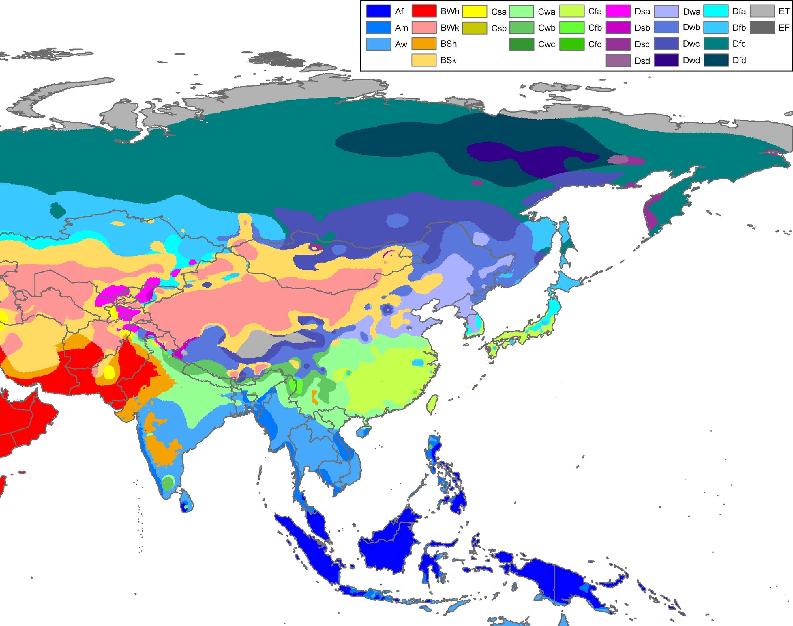
Officially, most of Inner Mongolia is classified as either a cold arid or steppe regime (Köppen BWk, BSk, respectively). The small portion besides these are classified as humid continental (Köppen Dwa/Dwb) in the northeast, or subarctic (Köppen Dwc) in the far north near Hulunbuir.[35]
| City | July (°C) | July (°F) | January (°C) | January (°F) |
|---|---|---|---|---|
| باوتو | 29.6/17.1 | 85.3/62.8 | −4.1/–16.8 | 24.7/1.8 |
| Bayannur | 30.7/17.9 | 87.3/64.2 | −3.3/–15.1 | 26.1/4.8 |
| Hohhot | 28.5/16.4 | 83.3/61.5 | −5/–16.9 | 23/1.6 |
| Ordos | 26.7/15.8 | 80.1/60.4 | −4.8/–14.7 | 23.4/5.5 |
| Ulanqab | 25.4/13.6 | 77.7/56.5 | −6.1/–18.5 | 21/–1.3 |
. . . . . . . . . . . . . . . . . . . . . . . . . . . . . . . . . . . . . . . . . . . . . . . . . . . . . . . . . . . . . . . . . . . . . . . . . . . . . . . . . . . . . . . . . . . . . . . . . . . . . . . . . . . . . . . . . . . . . . . . . . . . . . . . . . . . . . . . . . . . . . . . . . . . . . . . . . . . . . . . . . . . . . . .
التقسيمات الادارية
تنقسم منغوليا الداخلية إلى 12 تقسيم على مستوى المحافظة. وحتى أواخر عقد 1990، كان معظم المناطق المحافظاتية في منغوليا الشعبية تُعرف بإسم عصبة (صينية: 盟�)، وهو استخدام متبقي من التقسيمات المنغولية في أسرة چينگ. Similarly, county-level divisions are often known as Banners (صينية: 旗�). Since the 1990s, numerous Leagues have converted into prefecture-level cities, although Banners remain. The restructuring led to the conversion of primate cities in most leagues to convert to districts administratively (Hailar, Jining, and Dongsheng). Some newly founded prefecture-level cities have chosen to retain the original name of League (Hulunbuir, Bayannur, and Ulanqab), some have adopted the Chinese name of their primate city (Chifeng, Tongliao), and one League, Yekejuu, simply renamed itself اُردوس. Despite these recent administrative changes, there is no indication that the Alxa, Hinggan, and Xilingol Leagues will convert to prefecture-level cities in the near future.
| الخريطة | # | Conventional[36] | المقر الاداري | Hanzi Hanyu Pinyin |
Mongolian (Transcription from Mongolian) |
Population (2010) | |
|---|---|---|---|---|---|---|---|

| |||||||
| — Prefecture-level city — | |||||||
| 2 | Bayannur | Linhe District | 巴彦淖尔市 Bāyànnào'ěr Shì |
ᠪᠠᠶᠠᠨᠨᠠᠭᠤᠷ ᠬᠣᠲᠠ (Bayannaɣur qota) |
1,669,915 | ||
| 3 | ووهاي | Haibowan District | 乌海市 Wūhǎi Shì |
ᠦᠬᠠᠢ ᠬᠣᠲᠠ (Üqai qota) |
532,902 | ||
| 4 | Ordos | Dongsheng District | 鄂尔多斯市 È'ěrduōsī Shì |
ᠣᠷᠳᠣᠰ ᠬᠣᠲᠠ (Ordos qota) |
1,940,653 | ||
| 5 | باوتو | Hondlon District | 包头市 Bāotóu Shì |
ᠪᠤᠭᠤᠲᠤ ᠬᠣᠲᠠ (Buɣutu qota) |
2,650,364 | ||
| 6 | خوخخوت | Huimin District | 呼和浩特市 Hūhéhàotè Shì |
ᠬᠥᠬᠡᠬᠣᠲᠠ (Kökeqota) |
2,866,615 | ||
| 7 | Ulanqab | Jining District | 乌兰察布市 Wūlánchábù Shì |
ᠤᠯᠠᠭᠠᠨᠴᠠᠪ ᠬᠣᠲᠠ (Ulaɣančab qota) |
2,143,590 | ||
| 9 | Chifeng | Hongshan District | 赤峰市 Chìfēng Shì |
ᠤᠯᠠᠭᠠᠨᠬᠠᠳᠠ ᠬᠣᠲᠠ (Ulaɣanqada qota) |
4,341,245 | ||
| 10 | Tongliao | Horqin District | 通辽市 Tōngliáo Shì |
ᠲᠦᠩᠯᠢᠶᠣᠤ ᠬᠣᠲᠠ (Tüŋliyou qota) |
3,139,153 | ||
| 12 | Hulunbuir | Hailar District | 呼伦贝尔市 Hūlúnbèi'ěr Shì |
ᠬᠥᠯᠥᠨ ᠪᠤᠶᠢᠷ ᠬᠣᠲᠠ (Kölön Buyir qota) |
2,549,278 | ||
| — League — | |||||||
| 1 | ألشا | لواء ألشا الأيسر | 阿拉善盟 Ālāshàn Méng |
ᠠᠯᠠᠱᠠ ᠠᠶᠢᠮᠠᠭ (Alaša ayimaɣ) |
231,334 | ||
| 8 | Xilingol | Xilinhot | 锡林郭勒盟 Xīlínguōlè Méng |
ᠰᠢᠯᠢ ᠶᠢᠨ ᠭᠣᠣᠯ ᠠᠶᠢᠮᠠᠭ (Sili-yin Ɣool ayimaɣ) |
1,028,022 | ||
| 11 | Hinggan | Ulanhot | 兴安盟 Xīng'ān Méng |
ᠬᠢᠩᠭ᠋ᠠᠨ ᠠᠶᠢᠮᠠᠭ (Qiŋɣan ayimaɣ) |
1,613,250 | ||
Many of the prefecture-level cities were converted very recently from leagues.
The twelve prefecture-level divisions of Inner Mongolia are subdivided into 101 county-level divisions, including twenty-one districts, eleven county-level cities, seventeen counties, forty-nine banners, and three autonomous banners. Those are in turn divided into 1425 township-level divisions, including 532 towns, 407 townships, 277 sumu, eighteen ethnic townships, one ethnic sumu, and 190 subdistricts.
الاقتصاد
الألوية الذاتية الحكم
لواء ذاتي الحكم ( بالصينية : 自治旗 ؛بخط البينيين : zìzhìqí ) هو نوع خاص من الألوية التي أقامتها جمهورية الصين الشعبية.
هناك 3 ألوية ذاتية الحكم ، والتي تم تم انشاءها في شمال شرق منغوليا الداخلية ، وفيها مجموعة عرقية مختلفة عن قوميتي الهان او المنغول و تشكل الاغلبية في كل لواء وهي اقليات عرقية وطنية .
هذه الالوية الثلاثة هي:
لواء اوروكين ذاتي الحكم (鄂伦春自治旗) لمجموعة الاوروكين
لواء إيفنكي ذاتي الحكم (鄂温克族自治旗) لمجموعة الإيفنك
لواء مورين داوا داور ذاتي الحكم (莫力达瓦达斡尔族自治旗) لمجوعة الداور
الديمغرافيا

حين تأسست المنطقة الذاتية في 1947، كان صينيو الهان يشكلون 83.6% من السكان، بينما كان المنغول يشكلون 14.8% من السكان.[37] وبحلول عام 2000، انخفضت نسبة صينيي الهان إلى 79.2%. بينما منطقة هتاو ومعها النهر الأصفر واصلتا الانقلاب الدائم بين مزارعين من الجنوب وبدو من الشمال، the most recent episode of Han Chinese migration began in the early 18th century with encouragement من أسرة چينگ, and continued into the 20th century. Han Chinese live mostly in the Hetao region as well as various population centres in central and eastern Inner Mongolia. Over 70% of Mongols are concentrated in less than 18% of Inner Mongolia's territory (Hinggan League, and prefectures Tongliao and Chifeng).
| الأراضي ذات الأغلبية وشبه الأغلبية المنغولية[38][39] | ||
|---|---|---|
| اسم الراية | تعداد المنغول | النسبة |
| Horqin Right Middle Banner, Hinggan (2009) | 222,410 | 84.1% |
| New Barag Right Banner, Hulunbuir (2009) | 28,369 | 82.2% |
| Horqin Left Back Banner, Tongliao | 284,000 | 75% |
| New Barag Left Banner, Hulunbuir (2009) | 31,531 | 74.9% |
| Horqin Left Middle Banner, Tongliao | 395,000 | 73.5% |
| East Ujimqin Banner, Xilingol (2009) | 43,394 | 72.5% |
| West Ujimqin Banner, Xilingol | 57,000 | 65% |
| Sonid Left Banner, Xilingol (2006) | 20,987 | 62.6% |
| Bordered Yellow Banner, Xilingol | 19,000 | 62% |
| Hure Banner, Tongliao | 93,000 | 56% |
| Jarud Banner, Tongliao | 144,000 | 48% |
| Horqin Right Front Banner, Hinggan | 162,000 | 45% |
| Old Barag Banner, Hulunbuir (2006) | 25,903 | 43.6% |
| Jalaid Banner, Hinggan | 158,000 | 39% |
| Ar Khorchin Banner, Chifeng (2002) | 108,000 | 36.6% |
Mongols are the second largest ethnic group, comprising 17.1% of the population. They include many diverse Mongolian-speaking groups; groups such as the Buryats and the Oirats are also officially considered to be Mongols in China. Many of the traditionally nomadic Mongols have settled in permanent homes as their pastoral economy was collectivized during the Maoist Era.
Other ethnic groups include the Daur, the Evenks, the Oroqen, the Hui, the Manchus, and the Koreans.
| الجماعات العرقية في منغوليا الداخلية، تعداد 2000[40] | ||
|---|---|---|
| العرقية | التعداد | النسبة |
| صينيو الهان | 18,465,586 | 79.2% |
| المنغول | 3,995,349 | 17.1% |
| مانچو | 499,911 | 2.1% |
| هوي | 209,850 | 0.90% |
| داؤر | 77,188 | 0.33% |
| إڤنك | 26,201 | 0.11% |
| كوريون | 21,859 | 0.09% |
| الروس | 5,020 | 0.02% |
| Year | التعداد | صينيو الهان | المنغول | مانچو | |||
|---|---|---|---|---|---|---|---|
| 1953[41] | 6,100,104 | 5,119,928 | 83.9% | 888,235 | 14.6% | 18,354 | 0.3% |
| 1964[41] | 12,348,638 | 10,743,456 | 87.0% | 1,384,535 | 11.2% | 50,960 | 0.4% |
| 1982[41] | 19,274,281 | 16,277,616 | 84.4% | 2,489,378 | 12.9% | 237,149 | 1.2% |
| 1990[42] | 21,456,500 | 17,290,000 | 80.6% | 3,379,700 | 15.8% | ||
| 2000[43] | 23,323,347 | 18,465,586 | 79.2% | 3,995,349 | 17.1% | 499,911 | 2.3% |
| 2010[44] | 24,706,321 | 19,650,687 | 79.5% | 4,226,093 | 17.1% | ||
يستبعد أفراد جيش التحرير الشعبي في الخدمة.
اللغة والثقافة

الدين

According to a survey held in 2004 by the Minzu University of China, about 80% of the population of the region practice the worship of Heaven (that is named Tian in the Chinese tradition and Tenger in the Mongolian tradition) and of ovoo/aobao.[45]
Official statistics report that 10.9% of the population (3 million people) are members of Tibetan Buddhist groups.[46] According to the Chinese Spiritual Life Survey of 2007 and the Chinese General Social Survey of 2009, Christianity is the religious identity of 3.2% of the population of the region; and Chinese ancestral religion the professed belonging of 2.36%,[47] while a demographic analysis of the year 2010 reported that Muslims comprise the 0.91%.[48]
The cult of Genghis Khan, present in the form of various Genghis Khan temples, is a tradition of Mongolian shamanism, in which he is considered a cultural hero and divine ancestor, an embodiment of the Tenger (Heaven, God of Heaven).[49] His worship in special temples, greatly developed in Inner Mongolia since the 1980s, is also shared by the Han Chinese, claiming his spirit as the founding principle of the Yuan dynasty.[50]
البوذية التبتية (البوذية المنغولية, locally also known as "Yellow Buddhism") is the dominant form of Buddhism in Inner Mongolia, also practised by many Han Chinese. Another form of Buddhism, practised by the Chinese, are the schools of البوذية الصينية.
السياحة

مرئيات
| مقطع توثيقي عن حياة المسلمين والثقافة الإسلامية بمنغوليا الداخلية |
معرض صور
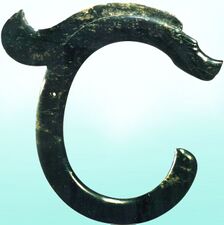
Jade dragon of the Hongshan culture (4700 BC – 2900 BC) found in Ongniud, Chifeng
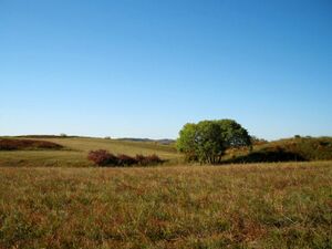
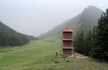
Ulaanbutan grassland
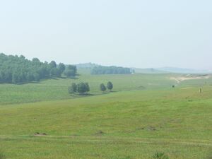
مراعي منغوليا الداخلية
Honorary tomb of Wang Zhaojun (born c. 50BC) in Hohhot
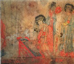
Fresco from the Liao dynasty (907–1125) tomb at Baoshan, Ar Horqin
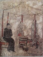
Khitan people cooking. Fresco from the Liao dynasty (907–1125) tomb at Aohan
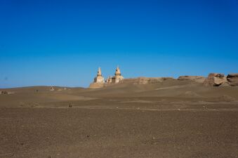
Remains of the city Khara-Khoto built in 1032. Located in Ejin Khoshuu, Alxa Aimag
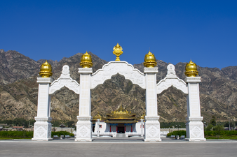
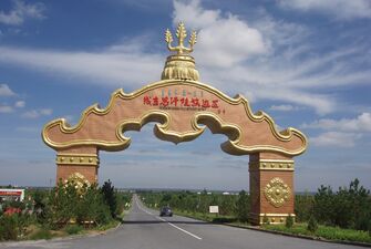
Newly built arch in front of the Maidari Juu temple fortress (1575)
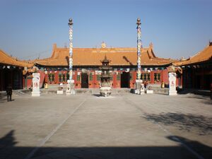
Da Zhao temple (also called Ikh Zuu) بناه ألطان خان في 1579
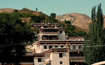
Badekar Monastery (1749) near Baotou, Inner Mongolia. Called Badgar Zuu بالمنغولية
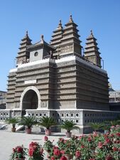
Five Pagoda temple (1727) في خوخخوت

Badain Jaran temple (1868) في غرب منغوليا الداخلية
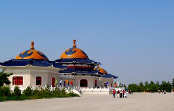
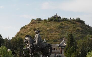
ضريح جنگيز خان (1954)
ضريح جنگيز خان (1954)
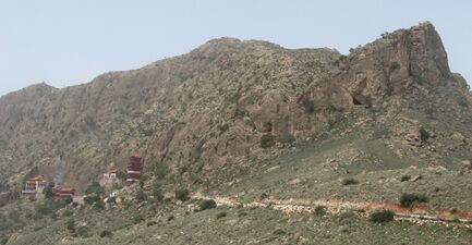
Alshaa mountain scenery
Alxa Western Monastery (Alshaa Baruun Hiid) مبنية في 1756


.jpg&filetimestamp=20220625140348&)


انظر أيضاً
ملاحظات
- ^ The provinces of the State of Mongolia in Outer Mongolia that border Inner Mongolia are, from east to west, Dornod, Sükhbaatar, Dornogovi, Ömnögovi, Bayankhongor, and Govi-Altai
- ^ The White Sulde (White Spirit) is one of the two spirits of Genghis Khan (the other being the Black Sulde), represented either as his white or yellow horse or as a fierce warrior riding this horse. In its interior, the temple enshrines a statue of Genghis Khan (at the center) and four of his men on each side (the total making nine, a symbolic number in Mongolian culture), there is an altar where offerings to the godly men are made, and three white suldes made with white horse hair. From the central sulde there are strings which hold tied light blue pieces of cloth with a few white ones. The wall is covered with all the names of the Mongol kins. The Chinese worship Genghis as the ancestral god of the Yuan dynasty.
الهامش
- ^ 内蒙古自治区区情
- ^ The Cyrillic spelling، كما تُستخدم في منغوليا، would be Өвөр Монголын Өөртөө Засах Орон (Övör Mongolyn Öörtöö Zasakh Oron).
In Unicode: ᠦᠪᠦᠷ
ᠮᠣᠩᠭᠤᠯ ᠤᠨ
ᠥᠪᠡᠷᠲᠡᠭᠡᠨ
ᠵᠠᠰᠠᠬᠣ
ᠣᠷᠣᠨ - ^ "Doing Business in China - Survey". Ministry Of Commerce - People's Republic Of China. Retrieved 5 August 2013.
- ^ "Tabulation on the 2010 Population Census of the People's Republic of China". stats.gov.cn. Archived from the original on 7 July 2013. Retrieved 7 May 2013.
- ^ Burnett, M. Troy (2020). Nationalism today: extreme political movements around the world (in English). p. 192. ISBN 978-1-4408-5000-4. OCLC 1137735471.
{{cite book}}: CS1 maint: unrecognized language (link) - ^ History of Mongolia, Volume I, 2003.
- ^ Records of the Grand Historian by Sima Qian.
- ^ CPAtwood-Encyclopedia of Mongolia and the Mongol Empire, p.246
- ^ Atwood, Christopher. Encyclopedia of Mongolia and the Mongol Empire, p. 449.
- ^ Reardon-Anderson, James (Oct 2000). "Land Use and Society in Manchuria and Inner Mongolia during the Qing Dynasty". Environmental History. 5 (4): 503–530. doi:10.2307/3985584. JSTOR 3985584. S2CID 143541438.
- ^ Bulag 2012, p. 41.
- ^ Charleux, Isabelle (2015). Nomads on Pilgrimage: Mongols on Wutaishan (China), 1800–1940. BRILL. p. 15. ISBN 978-9004297784.
- ^ The Cambridge History of China. Vol. 10. Cambridge University Press. 1978. p. 356.
- ^ Tsai, Wei-chieh (June 2017). Mongolization of Han Chinese and Manchu Settlers in Qing Mongolia, 1700–1911 (PDF) (Doctor of Philosophy in the Department of Central Eurasian Studies, Indiana University). ProQuest LLC. p. 7.
- ^ Liu, Xiaoyuan (2006). Reins of Liberation: An Entangled History of Mongolian Independence, Chinese Territoriality, and Great Power Hegemony, 1911–1950 (illustrated ed.). Stanford University Press. p. 117. ISBN 0804754268.
- ^ Borjigin, Burensain. "The Complex Structure of Ethnic Conflict in the Frontier: Through the Debates around the 'Jindandao Incident' in 1891". Inner Asia, vol. 6, no. 1, 2004, pp. 41–60. JSTOR, https://www.jstor.org/stable/23615320.
- ^ Atwood, Christopher. The Encyclopedia of Mongolia and the Mongol Empire, p. 454.
- ^ Atwood, Christopher. The Encyclopedia of Mongolia and the Mongol Empire, p. 91,
- ^ Belov, E. A. Anti-Chinese rebellion led by Babujav in Inner Mongolia, 1915–1916. – Annaly (Moscow), no. 2, 1996.
- ^ Belov, E. A. Rossiya i Mongoliya (1911–1919). Moscow: Vost. Lit. Publ.
- ^ أ ب Lin, Hsiao-ting (13 September 2010). "4 War and new frontier designs". Modern China's Ethnic Frontiers: A Journey to the West. Routledge Studies in the Modern History of Asia. Routledge. pp. 65–66. ISBN 978-1-136-92393-7.
- ^ Lin, Hsiao-ting (13 September 2010). "4 War and new frontier designs". Modern China's Ethnic Frontiers: A Journey to the West. Routledge Studies in the Modern History of Asia. Routledge. pp. 136–. ISBN 978-1-136-92392-0.
- ^ Lin, Hsiao-ting (13 September 2010). "4 War and new frontier designs". Modern China's Ethnic Frontiers: A Journey to the West. Routledge Studies in the Modern History of Asia. Routledge. p. 137. ISBN 978-1-136-92392-0. Archived from the original on 10 November 2018. Retrieved 24 May 2018.
- ^ David Sneath, "The Impact of the Cultural Revolution in China on the Mongolians of Inner Mongolia", in Modern Asian Studies, Vol. 28, No. 2 (May 1994), pp. 409–430.
- ^ Dikötter, Frank (2016). The Cultural Revolution: A People's History, 1962–1976 (1st U.S. ed.). New York: Bloomsbury Publishing USA. p. 191. ISBN 1632864223.
- ^ Chi Chi Zhang, CNN (19 April 2012). "Ethnic Mongolians in China concerned about cultural threat". CNN. Archived from the original on 2 April 2015. Retrieved 24 March 2015.
{{cite web}}:|author=has generic name (help) - ^ "Ordos, China: A Modern Ghost Town". Time. Archived from the original on 24 March 2015. Retrieved 24 March 2015.
- ^ Day, Peter (17 March 2012). "Ordos: The biggest ghost town in China". BBC News. Archived from the original on 24 June 2018. Retrieved 21 June 2018.
- ^ "Inner Mongolians culture clash". CNN. 18 April 2012. Archived from the original on 2 April 2015. Retrieved 24 March 2015.
- ^ http://www.rfa.org/english/news/china/launches-09052013110502.html Archived 2 أبريل 2015 at the Wayback Machine.
- ^ Gerry Shih (31 August 2020). "Chinese authorities face widespread anger in Inner Mongolia after requiring Mandarin-language classes". Washington Post. Retrieved 1 September 2020.
- ^ Amy Qin (31 August 2020). "Curbs on Mongolian Language Teaching Prompt Large Protests in China". New York Times. Retrieved 1 September 2020.
- ^ Luisetta Mudie, ed. (31 August 2020). "Mass Protests Erupt as China Moves to End Mongolian-Medium Teaching in Schools". Radio Free Asia. Translated by Luisetta Mudie. Retrieved 1 September 2020.
{{cite web}}: Cite uses deprecated parameter|authors=(help) - ^ أ ب Wei Zhang, Mingyue He, Yonghua Li, Zhijiu Cui, Zhilin Wang and Yang Yu; "Quaternary glacier development and the relationship between the climate change and tectonic uplift in the Helan Mountains" Archived 14 يونيو 2017 at the Wayback Machine; in Chinese Science Bulletin; December 2012, Volume 57, Issue 34, pp. 4491–4504.
- ^ Peel, M. C. and Finlayson, B. L. and McMahon, T. A. (2007). "Updated world map of the Köppen-Geiger climate classification" Archived 22 نوفمبر 2011 at the Wayback Machine. Hydrology and Earth System Sciences 11: 1633–1644.
- ^ Zhōngguó dìmínglù 中国地名录 (Beijing, Zhōngguó dìtú chūbǎnshè 中国地图出版社 1997); ISBN 7-5031-1718-4.
- ^ Myron Weiner, Sharon Stanton Russell(2001). Demography and national security. page 276, table 9.4.
- ^ "Baidu" network: Inner Mongolian Banner demographics (بالصينية)
- ^ "XZQH.org" network: Inner Mongolian Banner demographics (بالصينية)
- ^ Department of Population, Social, Science and Technology Statistics of the National Bureau of Statistics of China (国家统计局人口和社会科技统计司) and Department of Economic Development of the State Ethnic Affairs Commission of China (国家民族事务委员会经济发展司), eds. Tabulation on Nationalities of 2000 Population Census of China (《2000年人口普查中国民族人口资料》). 2 vols. Beijing: Nationalities Publishing House (民族出版社), 2003. (ISBN 7-105-05425-5)
- ^ أ ب ت (without Rehe)《中华人民共和国人口统计资料汇编1949—1985》,"People's Republic of demographic data compilation 1949-1985" 中国财政经济出版社,1988。第924页。 "China Financial and Economic Publishing House, 1988. Section 924."
- ^ 内蒙古自治区统计局(Inner Mongolia Autonomous Region Bureau of Statistics) 1990年第四次人口普查(4th National Census)。
- ^ 《2000年人口普查中国民族人口资料》, (5th National Census)民族出版社,2003。第4—8页。
- ^ (6th National Census) 内蒙古自治区发布2010年第六次全国人口普查主要数据公报。
- ^ Fenggang Yang, Graeme Lang. Social Scientific Studies of Religion in China. BRILL, 2012. ISBN 9004182462. pp. 184–185, reporting the results of surveys held in 2004 by the Minzu University of China. Quote from page 185: «[...] the registered adherents of the five official religions comprise only 3.7% of those [populations] in Inner Mongolia. When we compare this final statistic with Minzu University research team's finding that 80% of the inhabitants of Inner Mongolia worship Tian (loosely translated "Heaven") and aobao (traditional stone structures that serve as altars for sacrifice), it is evident that the official calculations of registered religious believers are markedly low, and the policy decisions based on these numbers lack the necessary grounding in reality. [...] Foreign religions can be transformed into indigenous ethnic religions, and the traditional folk religions of China's ethnic minorities can integrate and neutralize non-native religions. Thus, China's ethnic religions should not be regarded as social burdens or challenges, but rather as valuable cultural assets.»
- ^ Jiayu Wu, Yong Fang (2016). Study on the Protection of the Lama Temple Heritage in Inner Mongolia as a Cultural Landscape Archived 7 أبريل 2016 at the Wayback Machine. Journal of Asian Architecture and Building Engineering, v. 15 n. 1, January 2016. Note that the article, in an evident mistranslation from Chinese, reports 30 million Tibetan Buddhists in Inner Mongolia instead of 3 million.
- ^ Chinese Spiritual Life Survey (CSLS) 2007, China General Social Survey (CGSS) 2009. Results reported by: Xiuhua Wang (2015, p. 15) Archived 25 سبتمبر 2015 at the Wayback Machine
- ^ Min Junqing. The Present Situation and Characteristics of Contemporary Islam in China. JISMOR, 8. 2010 Islam by province, page 29 Archived 27 أبريل 2017 at the Wayback Machine. Data from: Yang Zongde, Study on Current Muslim Population in China, Jinan Muslim, 2, 2010.
- ^ John Man. Genghis Khan: Life, Death and Resurrection. Bantam Press, London, 2004. ISBN 9780553814989. pp. 402–404.
- ^ John Man. Genghis Khan. Bantam, 2005. ISBN 0553814982. p. 23.
وصلات خارجية