سكم
سِكِّــيم (نـپالي: सिक्किम , التبتية: Denzong[6]) هي ولاية صغيرة في شمال شرقي الهند تقع إلى الشرق من جبال الهملايا، تبلغ مساحتها 7,096 كم² ويسكنها 403,612 نسمة وعاصمتها گانگتوك أو جانجتوك. النشاط الرئيسي بالولاية هو زراعة القمح والذرة، والشعير والأرز بجانب صناعة التقطير والنسيج وتعدين الفحم الحجري والنحاس والذهب والحديد والرصاص. يحكم الولاية حاكم معين من رئيس الدولة يساعده مجلس وزاري في تصريف شؤون الولاية. A part of the Eastern Himalaya, Sikkim is notable for its biodiversity, including alpine and subtropical climates, as well as being a host to Kangchenjunga, the highest peak in India and third highest on Earth.[7] Sikkim's capital and largest city is Gangtok. Almost 35% of the state is covered by the Khangchendzonga National Park – a UNESCO World Heritage Site.[8]
سـِكـِّم
सिक्किम Sikkim | |||||||||||||||||||||
|---|---|---|---|---|---|---|---|---|---|---|---|---|---|---|---|---|---|---|---|---|---|
     (clockwise from top) Kangchenjunga; Gurudongmar Lake; Temi Tea Garden; Siddheshwar Dham Temple complex at Namchi; Rumtek Monastery | |||||||||||||||||||||
 Seal | |||||||||||||||||||||
 | |||||||||||||||||||||
| الإحداثيات (Gangtok): 27°20′N 88°37′E / 27.33°N 88.62°E | |||||||||||||||||||||
| البلد | |||||||||||||||||||||
| الانضمام للاتحاد [1] | 16 May 1975 | ||||||||||||||||||||
| العاصمة | گانگتوك | ||||||||||||||||||||
| Largest city | گانگتوك | ||||||||||||||||||||
| Districts | 4 | ||||||||||||||||||||
| الحكومة | |||||||||||||||||||||
| • الحاكم | Shriniwas Dadasaheb Patil | ||||||||||||||||||||
| • Chief Minister | Pawan Chamling (SDF) | ||||||||||||||||||||
| • التشريع | أحادي الغرفة (32 مقعد) | ||||||||||||||||||||
| • Parliamentary constituency | راجيا سابها 1 لوك سابها 1 | ||||||||||||||||||||
| • High Court | Sikkim High Court | ||||||||||||||||||||
| المساحة | |||||||||||||||||||||
| • الإجمالي | 7٬096 كم² (2٬740 ميل²) | ||||||||||||||||||||
| ترتيب المساحة | 29th | ||||||||||||||||||||
| التعداد (2016)[1] | |||||||||||||||||||||
| • الإجمالي | 644٬660 | ||||||||||||||||||||
| • الترتيب | 29th | ||||||||||||||||||||
| • الكثافة | 91/km2 (240/sq mi) | ||||||||||||||||||||
| اللغات[2] | |||||||||||||||||||||
| • الرسمية | نـِپالي الإنجليزية | ||||||||||||||||||||
| • الرسمية الاضافية | Bhutia, Gurung, Lepcha, Limbu, Manger, موخيا, نـِوَري، Rai, Sherpa, سكيمية، Tamang | ||||||||||||||||||||
| منطقة التوقيت | UTC+05:30 (IST) | ||||||||||||||||||||
| ISO 3166 code | IN-SK | ||||||||||||||||||||
| HDI | ▲ 0.684 (medium) | ||||||||||||||||||||
| HDI rank | 7th (2005) | ||||||||||||||||||||
| Literacy | 82.6% (13th) | ||||||||||||||||||||
| الموقع الإلكتروني | sikkim.gov.in | ||||||||||||||||||||
| |||||||||||||||||||||
| [2] The Assembly of Sikkim abolished monarchy and resolved to be a constituent unit of India. A referendum was held on these issues and a majority of voters voted yes. On 15 May 1975 the President of India ratified a constitutional amendment that made Sikkim the 22nd state of India. | |||||||||||||||||||||
The Kingdom of Sikkim was founded by the Namgyal dynasty in the 17th century. It was ruled by Buddhist priest-kings known as the Chogyal. It became a princely state of British India in 1890. Following Indian independence, Sikkim continued its protectorate status with the Union of India after 1947, and the Republic of India after 1950. It enjoyed the highest literacy rate and per capita income among Himalayan states. In 1973, anti-royalist riots took place in front of the Chogyal's palace. In 1975, after the Indian Army took over the city of Gangtok, a referendum was held that led to the deposition of the monarchy and Sikkim joining India as its 22nd state.[9]
Modern Sikkim is a multiethnic and multilingual Indian state. The official languages of the state are English, Nepali, Sikkimese and Lepcha.[10] Additional official languages include Gurung, Limbu, Magar, Mukhia, Newari, Rai, Sherpa and Tamang for the purpose of preservation of culture and tradition in the state.[2] English is taught in schools and used in government documents. The predominant religions are Hinduism and Vajrayana Buddhism. Sikkim's economy is largely dependent on agriculture and tourism. اعتبارا من 2014[تحديث], the state had the third-smallest GDP among Indian states,[11] although it is also among the fastest-growing.[11][12]
Sikkim accounts for the largest share of cardamom production in India, and is the world's second largest producer of the spice after Guatemala. Sikkim achieved its ambition to convert its agriculture to fully organic between 2003 and 2016, and became the first state in India to achieve this distinction.[13][14][15][16] It is also among India's most environmentally conscious states, having banned plastic water bottles "in any government functions and meetings" and polystyrene products (throughout the state).[17][18]
. . . . . . . . . . . . . . . . . . . . . . . . . . . . . . . . . . . . . . . . . . . . . . . . . . . . . . . . . . . . . . . . . . . . . . . . . . . . . . . . . . . . . . . . . . . . . . . . . . . . . . . . . . . . . . . . . . . . . . . . . . . . . . . . . . . . . . . . . . . . . . . . . . . . . . . . . . . . . . . . . . . . . . . .
أصل الاسم
The origin theory of the name Sikkim is that it is a combination of two Limbu words: su, which means "new", and khyim, which means "palace" or "house".[19] The Tibetan name for Sikkim is Drenjong (Wylie-transliteration: 'bras ljongs), which means "valley of rice",[6] while the Bhutias call it Beyul Demazong, which means '"the hidden valley of rice".[20] According to folklore, after establishing Rabdentse as his new capital, Bhutia king Tensung Namgyal built a palace and asked his Limbu Queen to name it. The Lepcha people, the original inhabitants of Sikkim, called it Nye-mae-el, meaning "paradise".[20] In historical Indian literature, Sikkim is known as Indrakil, the garden of the war god Indra.[21]
التاريخ

The Lepchas are considered to be the earliest inhabitants of Sikkim.[22] However the Limbus and the Magars also lived in the inaccessible parts of West and South districts as early as the Lepchas perhaps lived in the East and North districts.[23] The Buddhist saint Padmasambhava, also known as Guru Rinpoche, is said to have passed through the land in the 8th century.[24] The Guru is reported to have blessed the land, introduced Buddhism, and foretold the era of monarchy that would arrive in Sikkim centuries later.[بحاجة لمصدر]
تأسيس الملكية
.svg)
According to legend, Khye Bumsa, a 14th-century prince from the Minyak House in Kham in eastern Tibet, received a divine revelation instructing him to travel south to seek his fortunes. A fifth-generation descendant of Khye Bumsa, Phuntsog Namgyal, became the founder of Sikkim's monarchy in 1642, when he was consecrated as the first Chogyal, or priest-king, of Sikkim by the three venerated lamas at Yuksom.[25] Phuntsog Namgyal was succeeded in 1670 by his son, Tensung Namgyal, who moved the capital from Yuksom to Rabdentse (near modern Pelling). In 1700, Sikkim was invaded by the Bhutanese with the help of the half-sister of the Chogyal, who had been denied the throne. The Bhutanese were driven away by the Tibetan people, who restored the throne to the Chogyal ten years later. Between 1717 and 1733, the kingdom faced many raids by the Nepalese in the west and Bhutanese in the east, culminating with the destruction of the capital Rabdentse by the Nepalese.[26] In 1791, China sent troops to support Sikkim and defend Tibet against the Gorkha Kingdom. Following the subsequent defeat of Gorkha, the Chinese Qing dynasty established control over Sikkim.[27]

أثناء الراج البريطاني


Following the beginning of British rule in neighbouring India, Sikkim allied with Britain against their common adversary, Nepal. The Nepalese attacked Sikkim, overrunning most of the region including the Terai. This prompted the British East India Company to attack Nepal, resulting in the Gurkha War of 1814.[30] Treaties signed between Sikkim and Nepal resulted in the return of the territory annexed by the Nepalese in 1817. However, ties between Sikkim and the British weakened when the latter began taxation of the Morang region. In 1849, two British physicians, Sir Joseph Dalton Hooker and Dr. Archibald Campbell, the latter being in charge of relations between the British and Sikkimese governments, ventured into the mountains of Sikkim unannounced and unauthorised.[31] The doctors were detained by the Sikkimese government, leading to a punitive British expedition against the kingdom, after which the Darjeeling district and Morang were annexed to British India in 1853. The invasion led to the Chogyal of Sikkim becoming a titular ruler under the directive of the British governor.[32] In 1890, Sikkim became a British protectorate by means of a convention signed with China, although neither the governments of Sikkim nor Tibet was consulted.[33] Sikkim was gradually granted more sovereignty over the next three decades,[34] and became a member of the Chamber of Princes, the assembly representing the rulers of the Indian princely states, in 1922.[33]
المحمية ثم الولاية الهندية
.jpg)
الجغرافيا


Situated in the Himalayan mountains, the state of Sikkim is characterised by mountainous terrain. Almost the entire state is hilly, with an elevation ranging from 280 metres (920 ft) in the south at the border with West Bengal to 8,586 metres (28,169 ft) in northern peaks near Nepal and Tibet. The summit of Kangchenjunga, the world's third-highest peak, is the state's highest point, situated on the border between Sikkim and Nepal.[35] For the most part, the land is unfit for agriculture because of the rocky, precipitous slopes. However, some hill slopes have been converted into terrace farms.
_show_the_high,_arid,_Tibetan_Plateau_in_Asia._Tibet_lies_north_of_the_Himalaya_Mountains_in_Nepal---Tibet.A2002343.0445.1km.jpg)
Numerous snow-fed streams have carved out river valleys in the west and south of the state. These streams combine into the major Teesta River and its tributary, the Rangeet, which flow through the state from north to south.[36] About a third of the state is heavily forested. The Himalayan mountains surround the northern, eastern and western borders of Sikkim. The Lower Himalayas, lying in the southern reaches of the state, are the most densely populated.
The state has 28 mountain peaks, more than 80 glaciers,[37] 227 high-altitude lakes (including the Tsongmo, Gurudongmar and Khecheopalri Lakes), five major hot springs, and more than 100 rivers and streams. Eight mountain passes connect the state to Tibet, Bhutan and Nepal.[38]
Sikkim's hot springs are renowned for their medicinal and therapeutic value. Among the state's most notable hot springs are those at Phurchachu, Yumthang, Borang, Ralang, Taram-chu and Yumey Samdong. The springs, which have a high sulphur content, are located near river banks; some are known to emit hydrogen.[39] The average temperature of the water in these hot springs is 50 °C (122 °F).[40]
. . . . . . . . . . . . . . . . . . . . . . . . . . . . . . . . . . . . . . . . . . . . . . . . . . . . . . . . . . . . . . . . . . . . . . . . . . . . . . . . . . . . . . . . . . . . . . . . . . . . . . . . . . . . . . . . . . . . . . . . . . . . . . . . . . . . . . . . . . . . . . . . . . . . . . . . . . . . . . . . . . . . . . . .
الجيولوجيا

The hills of Sikkim mainly consist of gneiss and schist[41] which weather to produce generally poor and shallow brown clay soils. The soil is coarse, with large concentrations of iron oxide; it ranges from neutral to acidic and is lacking in organic and mineral nutrients. This type of soil tends to support evergreen and deciduous forests.[42]
The rock consists of phyllites and schists, and is highly susceptible to weathering and erosion. This, combined with the state's heavy rainfall, causes extensive soil erosion and the loss of soil nutrients through leaching. As a result, landslides are frequent, often isolating rural towns and villages from the major urban centres.[43]
المناخ
The state has five seasons: winter, summer, spring, autumn, and monsoon season. Sikkim's climate ranges from sub-tropical in the south to tundra in the north. Most of the inhabited regions of Sikkim experience a temperate climate, with temperatures seldom exceeding 28 °C (82 °F) in summer. The average annual temperature for most of Sikkim is around 18 °C (64 °F).
Sikkim is one of the few states in India to receive regular snowfall. The snow line ranges from 6,100 metres (20,000 ft) in the south of the state to 4,900 metres (16,100 ft) in the north.[44] The tundra-type region in the north is snowbound for four months every year, and the temperature drops below 0 °C (32 °F) almost every night.[39] In north-western Sikkim, the peaks are frozen year-round;[45] because of the high altitude, temperatures in the mountains can drop to as low as −40 °C (−40 °F) in winter.
During the monsoon, heavy rains increase the risk of landslides. The record for the longest period of continuous rain in Sikkim is 11 days. Fog affects many parts of the state during winter and the monsoons, making transportation perilous.[46]

الوحيش والنبيت


تقع سيكيم في نقطة ساخنة للتنوع البيولوجي في جبال الهيمالايا السفلى وهي واحدة من ثلاثة فقط من بين المناطق البيئة في الهند. المناطق التي تغطيها الغابات في هذه الولاية تتضمن مجموعة متنوعة من الحيوانات والنباتات. ونظراً لتدرج الارتفاعات فيها فأن لديها تشكيلة واسعة من النباتات من الأنواع الاستوائية المعتدلة وأنواع جبال الألب والتندرا، وربما تكون واحدة من عدد قليل من المناطق التي يتوفر فيها إمكانية وجود مثل هذا التنوع داخل هذه المنطقة الصغيرة. ويخضع ما يقرب من 81 في المئة من مساحة سيكيم لإدارة قسم الغابات فيها.[47]


سيكيم هي موطن لحوالي 5000 نوع من النباتات المزهرة و515 نوعاً من السحلبيات النادرة و60 نوعاً من زهرة الربيع و 36 نوعاًً من الردندرة و11 نوعاً من البلوط و23 نوعاًً من الخيزران و16 نوعاً الصنوبريات و362 نوعاً من السراخس وأشباه السراخس و8 أنواع من السراخس الشجرية وأكثر من 424 نوعاً من النباتات الطبية.[49] هناك أحد البديل من زهرة بنت القنصل (البونسيتة) المعروفة محليا باسم "زهرة عيد الميلاد" يمكن العثور عليها بوفرة في هذه الولاية الجبلية. أما الزهرة الرسمية في سيكيم فهي الدندربيون النبيل في حين أن الردندرة هي الشجرة الرسمية في الولاية.[50] وتشمل الحيوانات في سيكيم نمر الثلوج[51] الأيل المسكي وطهر الهيمالايا والباندا الأحمر ومرموط هيملايا وسيرو الهيمالايا وغورال الهيمالايا والمنتجق واللنغور الرمادي والدب الأسود الآسيوي والنمر الملطخ[52] والسنور المعرق والقط النمري[53] وكلب الدول والذئب التبتي وخنزير الغرير والقط الدبي وقط الغاب الهيمالاي. ومن بين الحيوانات الأكثر شيوعاً في المناطق الألبية المناخ في سيكيم هو القطاس الذي يربى أساسا بغرض الحصول على الحليب واللحوم وكحيوان لنقل الأحمال.
الحكم والسياسة

خطأ: الصورة غير صحيحة أو غير موجودة
According to the Constitution of India, Sikkim has a parliamentary system of representative democracy for its governance; universal suffrage is granted to state residents. The government structure is organised into three branches:
التقسيمات
Sikkim has four districts – East Sikkim, North Sikkim, South Sikkim and West Sikkim. The district capitals are Gangtok, Mangan, Namchi and Gyalshing respectively.[54] These four districts are further divided into 16 subdivisions; Pakyong, Rongli, Rangpo and Gangtok are the subdivisions of the East district. Soreng, Yuksom, Gyalshing and Dentam are the subdivisions of the West district. Chungthang, Dzongu, Kabi and Mangan are the subdivisions of the North district. Ravongla, Jorethang, Namchi and Yangyang are the subdivisions of the South district.[55]
Each of Sikkim's districts is overseen by a state government appointee, the district collector, who is in charge of the administration of the civilian areas of the district. The Indian Army has control over a large part of the state, as Sikkim forms part of a sensitive border area with China. Many areas are restricted to foreigners, and official permits are needed to visit them.[56]
النبيت والوحيش
Sikkim is situated in an ecological hotspot of the lower Himalayas, one of only three among the ecoregions of India.[58][59] The forested regions of the state exhibit a diverse range of fauna and flora. Owing to its altitudinal gradation, the state has a wide variety of plants, from tropical species to temperate, alpine and tundra ones, and is perhaps one of the few regions to exhibit such a diversity within such a small area. Nearly 81 per cent of the area of Sikkim comes under the administration of its forest department.[47]
Sikkim is home to around 5,000 species of flowering plants, 515 rare orchids, 60 primula species, 36 rhododendron species, 11 oak varieties, 23 bamboo varieties, 16 conifer species, 362 types of ferns and ferns allies, 8 tree ferns, and over 900 medicinal plants.[58][7] A relative of the Poinsettia, locally known as "Christmas Flower", can be found in abundance in the mountainous state. The Noble Dendrobium is the official flower of Sikkim, while the rhododendron is the state tree.[60]
Orchids, figs, laurel, bananas, sal trees and bamboo grow in the Himalayan subtropical broadleaf forests of the lower altitudes of Sikkim. In the temperate elevations above 1,500 metres (4,900 ft) there are Eastern Himalayan broadleaf forests, where oaks, chestnuts, maples, birches, alders, and magnolias grow in large numbers, as well as Himalayan subtropical pine forests, dominated by Chir pine. Alpine-type vegetation is typically found between an altitude of 3,500 to 5,000 metres (11,500 to 16,400 ft). In lower elevations are found juniper, pine, firs, cypresses and rhododendrons from the Eastern Himalayan subalpine conifer forests. Higher up are Eastern Himalayan alpine shrub and meadows and high-altitude wetlands, which are home to a wide variety of rhododendrons and wildflowers.[59][7]
The fauna of Sikkim include the snow leopard,[61] musk deer, Himalayan tahr, red panda, Himalayan marmot, Himalayan serow, Himalayan goral, muntjac, common langur, Asian black bear, clouded leopard,[62] marbled cat, leopard cat,[63] dhole, Tibetan wolf, hog badger, binturong, and Himalayan jungle cat. Among the animals more commonly found in the alpine zone are yaks, mainly reared for their milk, meat, and as a beast of burden.
The avifauna of Sikkim include the impeyan pheasant, crimson horned pheasant, snow partridge, Tibetan snowcock, bearded vulture and griffon vulture, as well as golden eagles, quails, plovers, woodcocks, sandpipers, pigeons, Old World flycatchers, babblers and robins. Sikkim has more than 550 species of birds, some of which have been declared endangered.[59]
Sikkim also has a rich diversity of arthropods, many of which remain unstudied.[59] Some of the most understudied species are Sikkimese arthropods, specifically butterflies. Of the approximately 1,438 butterfly species found in the Indian subcontinent, 695 have been recorded in Sikkim.[64] These include the endangered Kaiser-i-hind, the Yellow Gorgon and the Bhutan Glory.[65]
. . . . . . . . . . . . . . . . . . . . . . . . . . . . . . . . . . . . . . . . . . . . . . . . . . . . . . . . . . . . . . . . . . . . . . . . . . . . . . . . . . . . . . . . . . . . . . . . . . . . . . . . . . . . . . . . . . . . . . . . . . . . . . . . . . . . . . . . . . . . . . . . . . . . . . . . . . . . . . . . . . . . . . . .
الاقتصاد
Sikkim's nominal state gross domestic product (GDP) was estimated at US$4.6 billion in 2019, with GDP per capita being $7,530 (₹ 5,50,000) thus constituting the third-smallest GDP among India's 28 states.[11] The state's economy is largely agrarian based on the terraced farming of rice and the cultivation of crops such as maize, millet, wheat, barley, oranges, tea, and cardamom.[66][67] Sikkim produces more cardamom than any other Indian state and is home to the largest cultivated area of cardamom.[68]
Because of its hilly terrain and poor transport infrastructure, Sikkim lacks a large-scale industrial base. Brewing, distilling, tanning and watchmaking are the main industries and are mainly located in the southern regions of the state, primarily in the towns of Melli and Jorethang. In addition, a small mining industry exists in Sikkim extracting minerals such as copper, dolomite, talc, graphite, quartzite, coal, zinc, and lead.[69] Despite the state's minimal industrial infrastructure, Sikkim's economy has been among the fastest-growing in India since 2000; the state's GDP expanded by 89.93% in 2010 alone.[70] In 2003, Sikkim decided to fully convert to organic farming and achieved this goal in 2015 becoming India's first "organic state".[14][15][16][13]
In recent years, the government of Sikkim has extensively promoted tourism. As a result, state revenue has increased 14 times since the mid-1990s.[71] Sikkim has furthermore invested in a fledgling gambling industry promoting both casinos and online gambling. The state's first casino, the Casino Sikkim, opened in March 2009.[72] In the year 2010 the government subsequently issued three gambling licenses for casinos and online sports betting in general.[73]The Playwin lottery has been a notable success in the state.[74][75]
The opening of the Nathu La pass on 6 July 2006, connecting Lhasa, Tibet, to India, was billed as a boon for Sikkim's economy. Trade through the pass remains hampered by Sikkim's limited infrastructure and government restrictions in both India and China, though the volume of traded goods has been steadily increasing.[76][77]
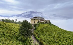
Temi Tea Garden, Namchi, Sikkim
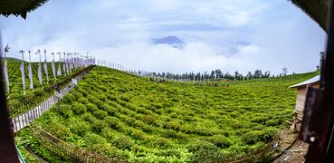
Tea garden at Temi, Sikkim.
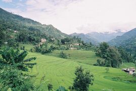
Terraced rice paddy fields of Sikkim.


السكان

| التعداد التاريخي | ||
|---|---|---|
| السنة | تعداد | ±% سنوياً |
| 1901 | 59٬014 | — |
| 1911 | 87٬920 | +4.07% |
| 1921 | 81٬721 | −0.73% |
| 1931 | 109٬808 | +3.00% |
| 1941 | 121٬520 | +1.02% |
| 1951 | 137٬725 | +1.26% |
| 1961 | 162٬189 | +1.65% |
| 1971 | 209٬843 | +2.61% |
| 1981 | 316٬385 | +4.19% |
| 1991 | 406٬457 | +2.54% |
| 2001 | 540٬851 | +2.90% |
| 2011 | 610٬577 | +1.22% |
| source:[78] | ||
Sikkim is India's least populous state, with 610,577 inhabitants according to the 2011 census.[1] Sikkim is also one of the least densely populated Indian states, with only 86 persons per square kilometre. However, it has a high population growth rate, averaging 12.36% per cent between 2001 and 2011. The sex ratio is 889 females per 1,000 males, with a total of 321,661 males and 286,027 females recorded in 2011. With around 98,000 inhabitants as of 2011, the capital Gangtok is the most significant urban area in the mostly rural state; in 2005, the urban population in Sikkim constituted around 11.06 per cent of the total.[79] In 2011, the average per capita income in Sikkim stood at ₹ 81,159 (US$1,305).[80]
Languages
The official languages of the state are English, Sikkimese Nepali, Sikkimese (Bhutia) and Lepcha. Additional official languages include Gurung, Limbu, Magar, Mukhia, Newar, Rai, Sherpa and Tamang for the purpose of preservation of culture and tradition in the state.
Nepali is the lingua franca of Sikkim, while Sikkimese (Bhutia) and Lepcha are spoken in certain areas.[82] English is also spoken and understood in most of Sikkim. Other languages include Dzongkha, Groma, Hindi, Majhi, Majhwar, Thulung, Tibetan, and Yakha.[83]
Ethnicity
The majority of Sikkim's residents are of Nepali ethnic origin.[84] The native Sikkimese consist of the Bhutias, who migrated from the Kham district of Tibet in the 14th century, and the Lepchas, who are believed to pre-date the Bhutias and are the oldest known inhabitants. Tibetans reside mostly in the northern and eastern reaches of the state. Migrant resident communities include Bengalis, Biharis and Marwaris, who are prominent in commerce in South Sikkim and Gangtok.[85]
Religion
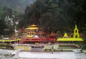
According to the 2011 census, 57.8% follow Hinduism, making it the state's majority religion. Buddhism is followed by 27.4% of the population, while Christianity is followed by 9.9%.[87] There are many Hindu temples throughout the state.[88]
Vajrayana Buddhism, which accounts for 27.3% of the population, is Sikkim's second-largest, yet most prominent religion. Prior to Sikkim's becoming a part of the Indian Union, Vajrayana Buddhism was the state religion under the Chogyal. Sikkim has 75 Buddhist monasteries, the oldest dating back to the 1700s.[89] The public and visual aesthetics of Sikkim are executed in shades of Vajrayana Buddhism and Buddhism plays a significant role in public life, even among Sikkim's majority Nepali Hindu population.
Christians in Sikkim are mostly descendants of Lepchas who were converted by British missionaries in the late 19th century, and constitute around 10% of the population. As of 2014, the Evangelical Presbyterian Church of Sikkim is the largest Christian denomination in Sikkim.[90] Other religious minorities include Muslims of Bihari ethnicity and Jains, who each account for roughly 1% of the population.[91] The traditional religions of the native Sikkimese account for much of the remainder of the population.
Although tensions between the Lepchas and the Nepalese escalated during the merger of Sikkim with India in the 1970s, there has never been any major degree of communal religious violence, unlike in other Indian states.[92][93] The traditional religion of the Lepcha people is Mun, an animist practice which coexists with Buddhism and Christianity.[94]
Kirateshwar Mahadev Temple in Legship is dedicated to Hindu God Shiva.
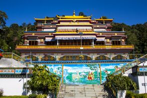
Rumtek Monastery
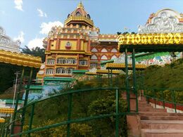
Vishwa Vinayak Temple at Rhenock


Districts
There are 6 districts in Sikkim, each overseen by a Central Government appointee, the district collector, who is in charge of the administration of the civilian areas of the districts. The Indian army has control of a large territory, as the state is a sensitive border area. Many areas are restricted and permits are needed to visit them. The four districts are:
| Code | District | Headquarters | Population (2011)[95] | Area (km²) | Density (/km²) | |
| ES | East Sikkim | Gangtok | 281,293 | 954 | 257 | |
| NS | North Sikkim | Mangan | 43,354 | 4,226 | 10 | |
| SS | South Sikkim | Namchi | 146,742 | 750 | 175 | |
| WS | West Sikkim | Geyzing | 136,299 | 1,166 | 106 | |
| PYS | Pakyong District | Pakyong | 74,583 | 404 | 180 | |
| SGS | Soreng District | Soreng | na | na | na |
نزاع سكم

 مقالة مفصلة: اشتباكات ناثو لا و تشو لا
اشتباكات ناثو لا و تشو لا، (11–14 سبتمبر 1967 في ناثو لا؛ 1 أكتوبر 1967 في تشو لا) كانت سلسلة من الاشتباكات العسكرية بين الهند والصين على طول حدود مملكة سكم في الهيمالايا، والتي كانت حينئذ محمية هندية.
وقد بدأت الاشتباكات في 11 سبتمبر 1967، حين شن جيش التحرير الشعبي (PLA) هجوماً على مواقع هندية في ناثو لا، والذي استمر حتى 15 سبتمبر 1967. وفي أكتوبر 1967، اندلع تبادل لاطلاق النار في تشو لا وانتهى في نفس اليوم.
وفي يوليو 2017 تجددت التحرشات.
انظر أيضاً
الهامش
- ^ أ ب "2011 Census reference tables – total population". Government of India. 2011. Archived from the original on 8 يوليو 2013. Retrieved 16 يوليو 2013.
- ^ أ ب "50th Report of the Commissioner for Linguistic Minorities in India" (PDF). 16 July 2014. p. 109. Retrieved 6 November 2016.
- ^ Dhar, T. N.; S. P. Gupta (1999). Tourism in Indian Himalaya. Lucknow: Indian Institute of Public Administration. p. 192. OCLC 42717797.
- ^ "States and Union Territories Symbols". knowindia.gov.in. Archived from the original on 12 نوفمبر 2013. Retrieved 13 يونيو 2016.
- ^ "Flora and Fauna". sikkimtourism.gov.in. Archived from the original on 17 أبريل 2016. Retrieved 13 يونيو 2016.
- ^ أ ب Bell, Charles Alfred (1987). Portrait of a Dalai Lama: the life and times of the great thirteenth. Wisdom Publications. p. 25. ISBN 978-0-86171-055-3.
- ^ أ ب ت O'Neill, Alexander; et al. (25 February 2020). "Establishing Ecological Baselines Around a Temperate Himalayan Peatland". Wetlands Ecology & Management. 28 (2): 375–388. doi:10.1007/s11273-020-09710-7. S2CID 211081106.
- ^ O'Neill, Alexander (29 March 2017). "Sikkim claims India's first mixed-criteria UNESCO World Heritage Site" (PDF). Current Science. 112 (5): 893–994. Archived (PDF) from the original on 29 March 2017. Retrieved 11 May 2017.
- ^ "Why is Sikkim's merger with India being questioned by China?". 11 July 2017. Archived from the original on 11 July 2017. Retrieved 11 July 2017.
- ^ خطأ استشهاد: وسم
<ref>غير صحيح؛ لا نص تم توفيره للمراجع المسماةlangoff1 - ^ أ ب ت "State-Wise GDP". Unidow.com. 2014. Archived from the original on 24 July 2012. Retrieved 7 January 2015.
- ^ Indian Ministry of Statistics and Programme Implementation Archived 3 مارس 2016 at the Wayback Machine. Retrieved 24 September 2011.
- ^ أ ب Paull, John (2017) "Four New Strategies to Grow the Organic Agriculture Sector" Archived 4 مارس 2018 at the Wayback Machine, Agrofor International Journal, 2(3):61–70.
- ^ أ ب "Sikkim becomes India's first organic state". Daily News and Analysis. 16 January 2016. Archived from the original on 18 January 2016. Retrieved 18 January 2016.
- ^ أ ب "Sikkim becomes India's first organic state". The Hindu. 14 January 2016. Archived from the original on 14 January 2016. Retrieved 18 January 2016.
- ^ أ ب "Organic show awaits Modi in Sikkim". Telegraph India. 17 January 2016. Archived from the original on 23 January 2016. Retrieved 18 January 2016.
- ^ "Ban on styrofoam products and on use of mineral water bottles in government functions and meetings in Sikkim". Archived from the original on 11 September 2016. Retrieved 2 September 2016.
- ^ Sharma, Shantanu Nandan (25 September 2016). "How Sikkim became the cleanest state in India". The Economic Times. Archived from the original on 13 June 2018. Retrieved 25 September 2016.
- ^ Ethnic Groups of South Asia and the Pacific: An Encyclopedia By James Minahan, 2012
- ^ أ ب "Welcome to Sikkim – General Information". Sikkim Tourism, Government of Sikkim. Archived from the original on 20 يناير 2009. Retrieved 16 مايو 2008.
- ^ Datta, Amaresh (2006) [1988]. Encyclopaedia of Indian literature vol. 2. Sahitya Akademi. p. 1739. ISBN 978-81-260-1194-0.
- ^ "Lepchas and their Tradition". Sikkim.nic.in. Archived from the original on 17 October 2017. Retrieved 6 July 2013.
- ^ Skoda, Uwe (2014). Navigating Social Exclusion and Inclusion in Contemporary India and Beyond: Structures, Agents, Practices (Anthem South Asian Studies). Anthem Press. p. 137. ISBN 978-1-78308-340-4.
- ^ "History of Guru Rinpoche". Sikkim Ecclesiastical Affairs Department. Archived from the original on 9 November 2013. Retrieved 9 November 2013.
- ^ Central Asia. Area Study Centre (Central Asia), University of Peshawar. v. 41, no. 2. 2005. pp. 50–53.
- ^ Singh, O. P. (1985). Strategic Sikkim. Stosius/Advent Books. p. 42. ISBN 978-0-86590-802-4.
- ^ Singh, O. P. p. 43
- ^ Sir Clements Robert Markham (1876). Narratives of the Mission of George Bogle to Tibet and of the Journey of Thomas Manning to Lhasa. ISBN 978-81-206-1366-9. Retrieved 12 June 2013.
- ^ Sir Clements Robert Markham (1876). Narratives of the Mission of George Bogle to Tibet and of the Journey of Thomas Manning to Lhasa. Via Google Books. Retrieved 12 June 2013.
- ^ Jha, Pranab Kumar (1985). History of Sikkim, 1817–1904: Analysis of British Policy and Activities. O.P.S. Publishers. p. 11. ASIN B001OQE7EY.
- ^ "Sikkim and Tibet". Blackwood's Edinburgh magazine. William Blackwood. 147: 658. May 1890.
- ^ "History of Sikkim". Government of Sikkim. 29 August 2002. Retrieved 12 October 2006.
- ^ أ ب Sethi, Sunil (30 April 1978). "Treaties: Annexation of Sikkim". intoday.in. Living Media India Limited. Retrieved 21 January 2016.
- ^ Bell, Charles (1992). Tibet: Past and Present. Motilal Banarsidass. pp. 170–174. ISBN 81-208-1048-1.
- ^ Madge, Tim (1995). Last Hero: Bill Tilman, a Biography of the Explorer. Mountaineers Books. p. 93. ISBN 978-0-89886-452-6.
- ^ "Rivers in Sikkim" Archived 15 أكتوبر 2011 at the Wayback Machine. Sikkim.nic.in. Retrieved 13 October 2011.
- ^ "First commission on study of glaciers launched by Sikkim". dstsikkim.gov.in. 18 يناير 2008. Archived from the original on 21 يوليو 2011. Retrieved 19 يونيو 2011.
- ^ Kapadia, Harish (2001). "Appendix". Across peaks & passes in Darjeeling & Sikkim. Indus Publishing. p. 154. ISBN 978-81-7387-126-9.
- ^ أ ب Choudhury 2006, p. 11.
- ^ Hooker, Joseph Dalton (1855). Himalayan Journals: Notes of a Naturalist. Vol. II. London: John Murray. p. 125.
- ^ "Geologic map of Sikkim". Archived from the original on 10 August 2017. Retrieved 10 August 2017.
- ^ Bhattacharya, B. (1997). Sikkim: Land and People. Omsons Publications. pp. 7–10. ISBN 978-81-7117-153-8.
- ^ "Terrain Analysis and Spatial Assessment of Landslide Hazards in Parts of Sikkim". Journal of the Geological Society of India v. 47. 1996. p. 491.
- ^ Hooker, Joseph Dalton (1854). Himalayan Journals: Notes of a Naturalist (version 2 ed.). John Murray. p. 396.
- ^ Choudhury 2006, p. 13.
- ^ Hooker p. 409
- ^ أ ب
{{cite web}}: Empty citation (help) خطأ استشهاد: وسم<ref>غير صالح؛ الاسم "forest-dept" معرف أكثر من مرة بمحتويات مختلفة. - ^ State Animals, Birds, Trees and Flowers of India
- ^
{{cite web}}: Empty citation (help) - ^
{{cite web}}: Empty citation (help) - ^ Wilson DE, Mittermeier RA (eds) (2009) Handbook of the Mammals of the World. Vol. 1. Carnivores. Lynx Edicions, Barcelona
- ^ Sanderson, J., Khan, J., Grassman, L. & Mallon, D.P. (2008). Neofelis nebulosa. القائمة الحمراء للأنواع المهددة بالانقراض 2008. IUCN سنة 2008. تم استرجاعها في 18 January 2009.
- ^ Mammals of Nepal. pp. 350–371.
{{cite book}}: Cite has empty unknown parameters:|lay-date=,|subscription=,|nopp=,|last-author-amp=,|name-list-format=,|lay-source=,|registration=, and|lay-summary=(help) - ^ Mathew, K. M. (ed.). "India". Manorama Yearbook 2009. Malayala Manorama. p. 660. ISBN 978-81-89004-12-5.
- ^ "List of Sdm". sikkim.gov.in. Retrieved 17 June 2019.
- ^ "Information of Foreign Tourist Interest". Sikkim.nic.in. Archived from the original on 23 May 2013. Retrieved 6 July 2013.
- ^ "State Animals, Birds, Trees and Flower". Archived from the original on 13 October 2014. Retrieved 26 July 2013.
- ^ أ ب O'Neill, Alexander; et al. (29 March 2017). "Integrating ethnobiological knowledge into biodiversity conservation in the Eastern Himalayas". Journal of Ethnobiology and Ethnomedicine. 13 (21): 21. doi:10.1186/s13002-017-0148-9. PMC 5372287. PMID 28356115.
{{cite journal}}: CS1 maint: unflagged free DOI (link) - ^ أ ب ت ث O'Neill, A. R. (2019). "Evaluating high-altitude Ramsar wetlands in the Sikkim Eastern Himalayas". Global Ecology and Conservation. 20 (e00715): 19. doi:10.1016/j.gecco.2019.e00715.
- ^ "State Animals, Birds, Trees and Flowers of India". Panna Tiger Reserve. Archived from the original on 13 October 2014. Retrieved 26 July 2013.
- ^ Wilson DE, Mittermeier RA (eds) (2009) Handbook of the Mammals of the World. Vol. 1. Carnivores. Lynx Edicions, Barcelona
- ^ Sanderson, J.; Khan, J.; Grassman, L. & Mallon, D.P. (2008). "Neofelis nebulosa". IUCN Red List of Threatened Species. 2008. Retrieved 18 January 2009.
- ^ Shrestha, Tej Kumar (1997). Mammals of Nepal. pp. 350–371. ISBN 978-0-9524390-6-6.
- ^ Evans 1932, p. 23.
- ^ Haribal 2003, p. 9.
- ^ Dutt, Ashok K.; Baleshwar Thakur (2007). City, Society and Planning: Society. Concept Publishing. p. 501. ISBN 978-81-8069-460-8.
- ^ Bareh 2001, pp. 20–21.
- ^ India: A Reference Annual. New Delhi: Research and Reference Division, Ministry of Information and Broadcasting. 2002. p. 747.
- ^ Mishra, R. K. (2005). State level public enterprises in Sikkim: policy and planning. Concept Publishing. p. 3. ISBN 978-81-8069-396-0.
- ^ "Indian states GDP database" (PDF). NIC.in. Archived from the original (PDF) on 15 يوليو 2014. Retrieved 24 ديسمبر 2014.
- ^ Dasgupta, Abhijit (May 2009). "Forever and ever and ever". India Today. 34 (22): 35. RNI:28587/75.
- ^ Patil, Ajit (28 مايو 2009). "Casinos in India". India Bet. Archived from the original on 9 أبريل 2011. Retrieved 28 أكتوبر 2009.
- ^ Sanjay, Roy (27 أكتوبر 2009). "Indian online gambling market set to open up". India Bet. Archived from the original on 10 مارس 2011. Retrieved 27 أكتوبر 2009.
- ^ Bakshi-Dighe, Arundhati (23 March 2003). "Online lottery: A jackpot for all". Indian Express. Retrieved 2 June 2009.
- ^ "Playwin lottery". Interplay Multimedia Pty. Ltd. 20 أغسطس 2006. Archived from the original on 18 أغسطس 2011. Retrieved 12 أكتوبر 2006.
- ^ "Nathu-la trade gets wider". Telegraph India. 9 May 2012. Archived from the original on 9 November 2013. Retrieved 6 July 2013.
- ^ "India China border trade at Nathu La closed for this year". India TV News. 3 December 2013. Archived from the original on 29 June 2017. Retrieved 16 January 2015.
- ^ "Census of India Website : Office of the Registrar General & Census Commissioner, India". www.censusindia.gov.in. Retrieved 6 January 2020.
- ^ خطأ استشهاد: وسم
<ref>غير صحيح؛ لا نص تم توفيره للمراجع المسماةStats - ^ "State-wise: Population, GSDP, Per Capita Income and Growth Rate" (PDF). Punjab State Planning Board. 2012. Archived (PDF) from the original on 11 November 2013. Retrieved 4 August 2013.
- ^ "Statement 1: Abstract of speakers' strength of languages and mother tongues - 2011". www.censusindia.gov.in. Office of the Registrar General & Census Commissioner, India. Retrieved 7 July 2018.
- ^ indiatoday.in/amp/education-today/gk-current-affairs/story/mini-sikkim-in-making-308081-2016-02-10
- ^ Bareh 2001, p. 10.
- ^ "The Ethnic People of Sikkim". PIB.NIC.in. 5 December 2003. Archived from the original on 5 December 2008. Retrieved 15 January 2015.
- ^ Clarence, Maloney (1974). Peoples of South Asia. Holt, Rinehart and Winston. p. 409. ISBN 978-0-03-084969-5.
- ^ "Census of India – Religious Composition". Government of India, Ministry of Home Affairs. Archived from the original on 13 September 2015. Retrieved 27 August 2015.
- ^ "C-1 Population By Religious Community – Sikkim". Census India. Archived from the original on 27 September 2015. Retrieved 16 June 2019.
- ^ "Sikkim" (PDF). National Commission for Women. Archived from the original (PDF) on 5 March 2016.
- ^ Bareh 2001, p. 9.
- ^ "Points of Ministry" Archived 29 يوليو 2014 at the Wayback Machine. IRFA.org.au. 2014. Retrieved 18 December 2014.
- ^ Singh, Kumar Suresh (1992). People of India: Sikkim. Anthropological Survey of India. p. 39. ISBN 978-81-7046-120-3.
- ^ Nirmalananda Sengupta (1985). State government and politics: Sikkim. Stosius/Advent Books. p. 140. ISBN 978-0-86590-694-5.
- ^ "Census and You – Religion" Archived 15 مارس 2018 at the Wayback Machine. Census India. Retrieved 20 October 2012.
- ^ Plaisier, Heleen (2007). Languages of the Greater Himalayan Region. A Grammar of Lepcha. Languages of the Greater Himalayan region. Vol. 5. Brill. pp. 4, 15 (photo). ISBN 978-90-04-15525-1. Archived from the original on 16 May 2016. Retrieved 15 November 2015.
- ^ "Ranking od (sic) Districts by Population Size" (XLS). The Registrar General & Census Commissioner, India, New Delhi-110011. 2010–2011. Retrieved 19 September 2011.
المصادر
- Evans, W.H. (1932) The Identification of Indian Butterflies. (2nd Ed), Bombay Natural History Society, Mumbai, India.
- Haribal, Meena (1992) Butterflies of Sikkim Himalaya and their Natural History. Sikkim Nature Conservation Foundation.
- Hooker, Joseph Dalton "Himalayan Journals" Ward, Lock, Bowden & Co. Assistant-director of the Royal Botanic Gardens, Kew.
- Holidaying in Sikkim and Bhutan – published by Nest and Wings – ISBN 81-87592-07-9
- Sikkim — Land of Mystic and Splendour – published by Sikkim Tourism.
- Manorama Yearbook 2003 – ISBN 81-900461-8-7
وصلات خارجية
| سكم
]].- Official website of the Government of Sikkim, Maintained by Department of Information Technology
- "Details of the census". Archived from the original on 19 June 2006.
- Sinlung News
- Buddhist Monasteries of Sikkim
- China backs India's bid for U.N. Council seat; Amit Baruah; The Hindu 2005-04-12.
- Historic India-China link opens, BBC News.
- سكم at the Open Directory Project
- سكم travel guide from Wikitravel