لندن الكبرى

لندن الكبرى Greater London، هو منطقة ادارية، مقاطعة احتفالية، واقليم في إنگلترة.[2] تأسست كمنطقة للحكومة المحلية في 1 أبريل 1965، وكانت تضم مدينة لندن و32 ضاحية.[3] تأسست المقاطعة الاحتفالية بنفس الاسم، واستخدم لأهداف لورد لندن الكبرى، ولم تكن تشمل مدينة لندن.[4] وتضم سلطة لندن الكبرى عمدة لندن ومجلس لندن، ومقرها الرئيسي في قاعة المدينة، وهي المسئولة عن الحكومة المحلية الاستراتيجية منذ عام 2000. تحتل لندن الكبرى مساحة مماثلة لمساحة دائرة لندن الانتخابية الأوروپية. وهي أحد اللأقاليم التسعة الرسمية من المستوى الأول لأغراض إحصائية، وتغطي مساحة 1572 كم²[5] ووصل عدد سكانها في تعداد 2011 إلى 8,174,000 نسمة.[6]
. . . . . . . . . . . . . . . . . . . . . . . . . . . . . . . . . . . . . . . . . . . . . . . . . . . . . . . . . . . . . . . . . . . . . . . . . . . . . . . . . . . . . . . . . . . . . . . . . . . . . . . . . . . . . . . . . . . . . . . . . . . . . . . . . . . . . . . . . . . . . . . . . . . . . . . . . . . . . . . . . . . . . . . .
التاريخ
مقترحات توسيع مقاطعة لندن
التأسيس الرسمي للندن الكبرى

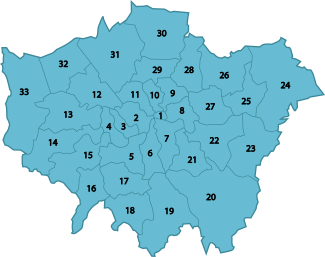
الجغرافيا
خطأ لوا في وحدة:Location_map/multi على السطر 27: Unable to find the specified location map definition: "Module:Location map/data/لندن الكبرى" does not exist.
الحكومة

الحكومة المحلية الاستراتيجية
الحكومة المحلية
  |
مجلس لنون
برلمان المملكة المتحدة
الديموغرافيا
| تعداد المملكة المتحدة 2001[7] | |
|---|---|
| بلد الميلاد | التعداد |
| 5,230,155 | |
| 172,162 | |
| 157,285 | |
| 84,565 | |
| 80,319 | |
| 68,907 | |
| 66,658 | |
| 66,311 | |
| 49,932 | |
| 46,513 | |
| 45,888 | |
| 45,506 | |
| 44,622 | |
| 41,488 | |
| 39,818 | |
| 39,128 | |
| 38,694 | |
| 38,130 | |
| 33,831 | |
| 32,082 | |
| 27,494 | |
. . . . . . . . . . . . . . . . . . . . . . . . . . . . . . . . . . . . . . . . . . . . . . . . . . . . . . . . . . . . . . . . . . . . . . . . . . . . . . . . . . . . . . . . . . . . . . . . . . . . . . . . . . . . . . . . . . . . . . . . . . . . . . . . . . . . . . . . . . . . . . . . . . . . . . . . . . . . . . . . . . . . . . . .
الجماعات العرقية
السكان

| 1891 | 5–6 أبريل | 5,572,012 |
| 1901 | 31 مارس – 1 أبريل | 6,506,954 |
| 1911 | 2–3 أبريل | 7,160,525 |
| 1921 | 19–20 يونيو | 7,386,848 |
| 1931 | 26–27 أبريل | 8,110,480 |
| 1939 | تقديرات نصف العام | 8,615,245 |
| 1951 | 8–9 أبريل | 8,196,978 |
| 1961 | 23–24 أبريل | 7,992,616 |
| 1965 | تأسست لندن الكبرى رسمياً | |
| 1971 | 25–26 أبريل | 7,452,520 |
| 1981 | تقديرات نصف العام | 6,805,000[8] |
| 1988 | تقديرات نصف العام | 6,729,300[9] |
| 1991 | تقديرات نصف العام | 6,829,300[10] |
| 2001 | تقديرات نصف العام | 7,322,400[11] |
| 2002 | تقديرات نصف العام | 7,361,600[12] |
| 2003 | تقديرات نصف العام | 7,364,100[13] |
| 2004 | تقديرات نصف العام | 7,389,100[14] |
| 2005 | تقديرات نصف العام | 7,456,100[15] |
| 2006 | تقديرات نصف العام | 7,512,400[6] |
| 2009 | تقديرات نصف العام | 7,753,600[6] |
زيادة عدد السكان
الاقتصاد
| السنة | القيمة المضافة الاجمالية المحلية[16] | Agriculture[17] | Industry[18] | Services[19] |
|---|---|---|---|---|
| 1995 | 64,616 | 7 | 8,147 | 56,461 |
| 2000 | 92,330 | 6 | 10,094 | 82,229 |
| 2003 | 112,090 | 12 | 10,154 | 101,924 |
| السنة | القيمة المضافة الاجمالية المحلية[16] | الزراعة[17] | الصناعة[18] | الخدمات[19] |
|---|---|---|---|---|
| 1995 | 44,160 | 51 | 10,801 | 33,307 |
| 2000 | 60,304 | 43 | 12,529 | 47,732 |
| 2003 | 67,582 | 39 | 13,081 | 54,462 |
الديانات


تضم أكبر الجماعات الدينية في لندن المسحيين (58.2%)، المسلمين (8.2%)، الهندوس (4.1%)، يهود (2.1%)، والسيخ (1.5%)، بالإضافة إلى أشخاص بلا دين (15.8%).
التعليم

الجامعات
التوأمة
سلطة لندن الكبرى على علاقة توأمة واتفاقيات شقاقة مع المدن التالية:[20]
| البلد | المدينة | المقاطعة/ المنطقة/ الاقليم/ الولاية | التاريخ | |
|---|---|---|---|---|
| الصين | بكين | بلدية بكين | 2006[21] | |
| فرنسا | باريس | إل-ده-فرانس | ||
| ألمانيا | برلين | برلين | 2000 | |
| روسيا | موسكو | المقاطعة الفدرالية المركزية | ||
| الولايات المتحدة | مدينة نيويورك | نيويورك | 2001[22] | |
| اليابان | طوكيو | طوكيو | 2005 |
. . . . . . . . . . . . . . . . . . . . . . . . . . . . . . . . . . . . . . . . . . . . . . . . . . . . . . . . . . . . . . . . . . . . . . . . . . . . . . . . . . . . . . . . . . . . . . . . . . . . . . . . . . . . . . . . . . . . . . . . . . . . . . . . . . . . . . . . . . . . . . . . . . . . . . . . . . . . . . . . . . . . . . . .
انظر أيضاً

الجغرافيا
- وسط لندن
- لندن الداخلية
- لندن الخارجية
- London borough
- المنطقة الحضرية للندن الكبرى
- London commuter belt
- Metropolitan Police District
- M25 motorway
سياسية
- عمدة لندن
- List of Lord Lieutenants of Greater London
- List of High Sheriffs of Greater London
- خطة لندن
- مدينة لندن
تاريخية
أخرى
الهوامش
المصادر
- ^ "No. 62943". The London Gazette. 13 March 2020. p. 5161.
- ^ Travers, T., The Politics of London, (2004)
- ^ London Government Act 1963
- ^ Administration of Justice Act 1964
- ^ "Our Region". www.gol.gov.uk. Government Office for London. Retrieved 15 October 2009.
- ^ أ ب ت "T 08: 2011 Census — Population and Household Estimates for England and Wales, March 2011" (PDF). Office for National Statistics. 16 July 2012. Retrieved 16 July 2012.
- ^ "A summary of countries of birth in London". Census Update. Greater London Authority Data Management Access Group. 2006/09: page 3. April 2006. Archived from the original on 2011-03-11. Retrieved 4 January 2011.
{{cite journal}}:|page=has extra text (help) - ^ "T 08: Quinary age group and sex for local authorities in England and Wales; estimated resident population based on the 1991 Census; Mid-1981 Population Estimates". Office for National Statistics. 22 August 2007. Retrieved 22 August 2007.
- ^ "T 08h: Mid-1988 Population Estimates; Quinary age groups and sex for local authorities in England and Wales; estimated resident population revised in light of results of the 2001 Census". Office for National Statistics. 22 August 2007. Retrieved 22 August 2007.
- ^ "T 09a: Mid-1991 Population Estimates; Quinary age groups and sex for local authorities in the United Kingdom; estimated resident population". Office for National Statistics. 22 August 2007. Retrieved 22 August 2007.
- ^ "T 08: Selected age groups for local authorities in the United Kingdom; estimated resident population; revised in light of the local authority population studies; Mid-2001 Population Estimates". Office for National Statistics. 22 August 2007. Retrieved 22 August 2007.
- ^ "T 09L: Quinary age groups and sex for local authorities in the United Kingdom; estimated resident population Mid-2002 Population Estimates; reflecting the revisions due to improved international migration". Office for National Statistics. 22 August 2007. Retrieved 22 August 2007.
- ^ "T 09m: Quinary age groups and sex for local authorities in the United Kingdom; estimated resident population Mid-2003 Population Estimates; reflecting the revisions due to improved international migration". Office for National Statistics. 22 August 2007. Retrieved 22 August 2007.
- ^ "T 09n: Quinary age groups and sex for local authorities in the United Kingdom; estimated resident population Mid-2004 Population Estimates; reflecting the revisions due to improved international migration". Office for National Statistics. 22 August 2007. Retrieved 22 August 2007.
- ^ "T 09p: Quinary age groups and sex for local authorities in the United Kingdom; estimated resident population Mid-2005 Population Estimates; reflecting the revisions due to improved international migration". Office for National Statistics. 22 August 2007. Retrieved 22 August 2007.
- ^ أ ب Components may not sum to totals due to rounding
- ^ أ ب تشمل الصيد والغابات
- ^ أ ب تشمل الطاقة والانشاءات
- ^ أ ب تشمل الخدمات المالية
- ^ The Mayor of London's City Partnerships webpage
- ^ "Beijing, London to be sister cities", China Daily, 11 April 2006. Retrieved on 6 June 2006.
- ^ "Sister City — London". nyc.gov. Retrieved 3 February 2007.
وصلات خارجية
- Greater London Authority
- Greater London Online — London Community News, Information and Business Directory
- Greater London Business Community Directory
- لندن الكبرى at the Open Directory Project
Coordinates: 51°30′N 0°5′W / 51.500°N 0.083°W
| Greater London
]].