ملف:Wolof Empire states.svg

حجم معاينة PNG لذلك الملف ذي الامتداد SVG: 200 × 151 بكسل. البعد الآخر: 2٬560 × 1٬933 بكسل.
الملف الأصلي (ملف SVG، أبعاده 200 × 151 بكسل، حجم الملف: 335 كيلوبايت)
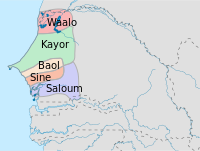
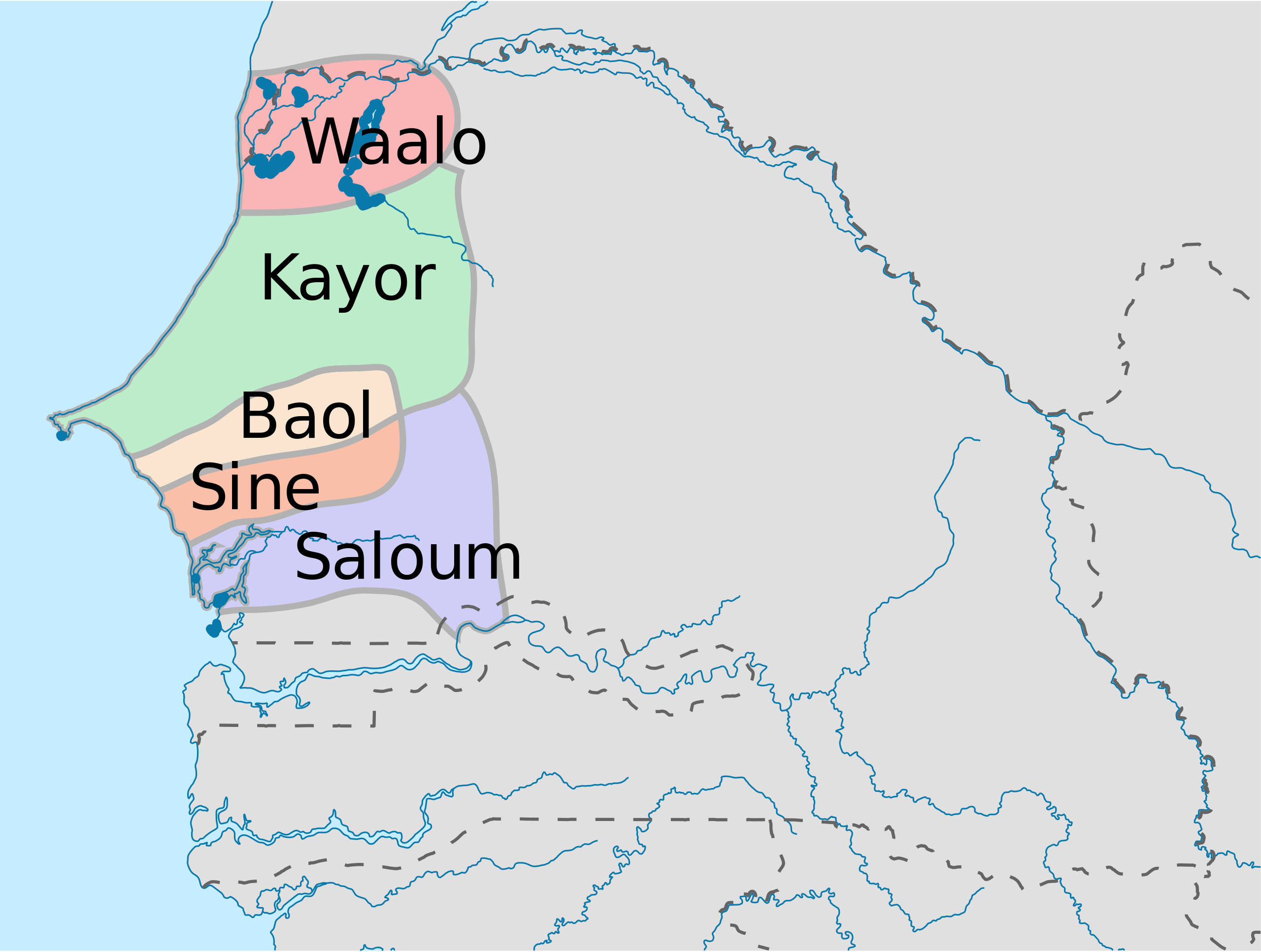
Le grand Djolof lots de LA bataille de Danki
وصف قصير
| ⧼wm-license-information-description⧽ |
English: Constituent States of the Wolof Empire
Created to replace the jpg version of the file. Map has been drawn starting from an historical map: http://www.provincia.torino.gov.it/xatlante/mediaecomunita/imgs/regnisenegalesi.gif. |
| ⧼wm-license-information-date⧽ | 2013, 7:03 pm UTC+16:00 [refresh] |
| ⧼wm-license-information-source⧽ | ⧼Wm-license-own-work⧽ |
| ⧼wm-license-information-author⧽ | Mikima |

ترخيص
|
تاريخ الملف
اضغط على زمن/تاريخ لرؤية الملف كما بدا في هذا الزمن.
| زمن/تاريخ | صورة مصغرة | الأبعاد | مستخدم | تعليق | |
|---|---|---|---|---|---|
| حالي | ★ مراجعة معتمدة 04:18، 10 نوفمبر 2023 | | 200 × 151 (335 كيلوبايت) | Pastakhov (نقاش | مساهمات) | Upload https://upload.wikimedia.org/wikipedia/commons/a/a1/Wolof_Empire_states.svg |
لا يمكنك استبدال هذا الملف.
وصلات
لا يوجد صفحات تصل لهذه الصورة.