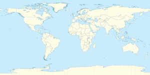
خط الطول 26 شرق

خط الطول 26 شرق Greenwich is a line of longitude that extends from the North Pole across the Arctic Ocean, Europe, Africa, the Indian Ocean, the Southern Ocean, and Antarctica to the South Pole.

Line across the Earth
26°
خط الطول 26 شرق

The 26th meridian east forms a great circle with the 154th meridian west.

. . . . . . . . . . . . . . . . . . . . . . . . . . . . . . . . . . . . . . . . . . . . . . . . . . . . . . . . . . . . . . . . . . . . . . . . . . . . . . . . . . . . . . . . . . . . . . . . . . . . . . . . . . . . . . . . . . . . . . . . . . . . . . . . . . . . . . . . . . . . . . . . . . . . . . . . . . . . . . . . . . . . . . . .

From Pole to Pole

Starting at the North Pole and heading south to the South Pole, the 26th meridian east passes through:

Co-ordinates Country, territory or sea Notes
90°0′N 26°0′E / 90.000°N 26.000°E / 90.000; 26.000 (Arctic Ocean) Arctic Ocean
80°10′N 26°0′E / 80.167°N 26.000°E / 80.167; 26.000 (Norway)   نرويج Island of Nordaustlandet, سڤالبارد
79°40′N 26°0′E / 79.667°N 26.000°E / 79.667; 26.000 (Barents Sea) Barents Sea
71°8′N 26°0′E / 71.133°N 26.000°E / 71.133; 26.000 (Norway)   نرويج Island of Magerøya
70°58′N 26°0′E / 70.967°N 26.000°E / 70.967; 26.000 (Porsangerfjorden) Porsangerfjorden
70°39′N 26°0′E / 70.650°N 26.000°E / 70.650; 26.000 (Norway)   نرويج
69°43′N 26°0′E / 69.717°N 26.000°E / 69.717; 26.000 (Finland)   فنلندا
60°16′N 26°0′E / 60.267°N 26.000°E / 60.267; 26.000 (Baltic Sea) Baltic Sea Gulf of Finland
59°37′N 26°0′E / 59.617°N 26.000°E / 59.617; 26.000 (Estonia)   إستونيا
57°52′N 26°0′E / 57.867°N 26.000°E / 57.867; 26.000 (Latvia)   لاتفيا
55°58′N 26°0′E / 55.967°N 26.000°E / 55.967; 26.000 (Lithuania)   لتوانيا
54°57′N 26°0′E / 54.950°N 26.000°E / 54.950; 26.000 (Belarus)   بلاروس
51°56′N 26°0′E / 51.933°N 26.000°E / 51.933; 26.000 (Ukraine)   أوكرانيا Rivne Oblast — passing just east of Varash
Volyn Oblast — for about 9 km
Rivne Oblast — for about 6 km
Volyn Oblast — for about 13 km
Rivne Oblast — passing just west of Rivne
Ternopil Oblast — passing just west of Borshchiv
Chernivtsi Oblast — passing through Chernivtsi
47°58′N 26°0′E / 47.967°N 26.000°E / 47.967; 26.000 (Romania)   رومانيا Passing just west of Bucharest
43°53′N 26°0′E / 43.883°N 26.000°E / 43.883; 26.000 (Bulgaria)   بلغاريا Passing just east of Ruse
41°20′N 26°0′E / 41.333°N 26.000°E / 41.333; 26.000 (Greece)   اليونان
40°49′N 26°0′E / 40.817°N 26.000°E / 40.817; 26.000 (Mediterranean Sea) Mediterranean Sea Aegean Sea
40°9′N 26°0′E / 40.150°N 26.000°E / 40.150; 26.000 (Turkey)   تركيا Island of Imbros
40°8′N 26°0′E / 40.133°N 26.000°E / 40.133; 26.000 (Mediterranean Sea) Mediterranean Sea Aegean Sea
39°51′N 26°0′E / 39.850°N 26.000°E / 39.850; 26.000 (Turkey)   تركيا Island of Bozcaada
39°49′N 26°0′E / 39.817°N 26.000°E / 39.817; 26.000 (Mediterranean Sea) Mediterranean Sea Aegean Sea
39°17′N 26°0′E / 39.283°N 26.000°E / 39.283; 26.000 (Greece)   اليونان Island of Lesbos
39°7′N 26°0′E / 39.117°N 26.000°E / 39.117; 26.000 (Mediterranean Sea) Mediterranean Sea Aegean Sea
38°36′N 26°0′E / 38.600°N 26.000°E / 38.600; 26.000 (Greece)   اليونان Island of Chios
38°10′N 26°0′E / 38.167°N 26.000°E / 38.167; 26.000 (Mediterranean Sea) Mediterranean Sea Aegean Sea
37°34′N 26°0′E / 37.567°N 26.000°E / 37.567; 26.000 (Greece)   اليونان Island of Icaria
37°31′N 26°0′E / 37.517°N 26.000°E / 37.517; 26.000 (Mediterranean Sea) Mediterranean Sea Aegean Sea
36°56′N 26°0′E / 36.933°N 26.000°E / 36.933; 26.000 (Greece)   اليونان Island of Amorgos
36°53′N 26°0′E / 36.883°N 26.000°E / 36.883; 26.000 (Mediterranean Sea) Mediterranean Sea Aegean Sea
35°12′N 26°0′E / 35.200°N 26.000°E / 35.200; 26.000 (Greece)   اليونان Island of Crete
35°1′N 26°0′E / 35.017°N 26.000°E / 35.017; 26.000 (Mediterranean Sea) Mediterranean Sea
31°36′N 26°0′E / 31.600°N 26.000°E / 31.600; 26.000 (Egypt)   مصر
22°0′N 26°0′E / 22.000°N 26.000°E / 22.000; 26.000 (Sudan)   السودان
10°9′N 26°0′E / 10.150°N 26.000°E / 10.150; 26.000 (South Sudan)   جنوب السودان
7°0′N 26°0′E / 7.000°N 26.000°E / 7.000; 26.000 (Central African Republic)   أفريقيا الوسطى
5°14′N 26°0′E / 5.233°N 26.000°E / 5.233; 26.000 (Democratic Republic of the Congo)   الكونغو الديمقراطية
11°56′S 26°0′E / 11.933°S 26.000°E / -11.933; 26.000 (Zambia)   زامبيا
17°59′S 26°0′E / 17.983°S 26.000°E / -17.983; 26.000 (Zimbabwe)   زيمبابوي
19°9′S 26°0′E / 19.150°S 26.000°E / -19.150; 26.000 (Botswana)   بوتسوانا Passing just east of Gaborone
24°43′S 26°0′E / 24.717°S 26.000°E / -24.717; 26.000 (South Africa)   جنوب أفريقيا North West
Free State
Eastern Cape
33°43′S 26°0′E / 33.717°S 26.000°E / -33.717; 26.000 (Indian Ocean) Indian Ocean
60°0′S 26°0′E / 60.000°S 26.000°E / -60.000; 26.000 (Southern Ocean) Southern Ocean
70°9′S 26°0′E / 70.150°S 26.000°E / -70.150; 26.000 (Antarctica) أنتارتيكا Queen Maud Land, claimed by   نرويج


انظر أيضاً