بيلجيك
بيلجيك Bilecik هي مدينة في شمال غرب الأناضول، وهي مقر كلٍ من محافظة بيلجيك و مقاطعة بيلجيك.[2] Its population is 74,457 (2021).[1] The mayor is Melek Mızrak Subaşı (CHP).
Bilecik | |
|---|---|
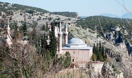
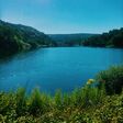
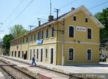
Clockwise from top:Tomb of Sheikh Edebali, Küçükelmalı Natural Park, Bilecik railway station,
Tomb of Ertuğrul, Tomb of Dursun Fakıh, Panorama of Bilecik | |
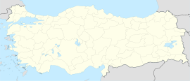
| الإحداثيات: 40°08′35″N 29°58′45″E / 40.14306°N 29.97917°ECoordinates: 40°08′35″N 29°58′45″E / 40.14306°N 29.97917°E | |
| البلد | تركيا |
| المحافظة | Bilecik |
| القضاء | Bilecik |
| الحكومة | |
| • العمدة | Melek Mızrak Subaşı (CHP) |
| التعداد (2021)[1] | 74٬457 |
| منطقة التوقيت | TRT (UTC+3) |
| Postal code | 11000 |
| Area code | 0228 |
| الموقع الإلكتروني | www |
The town is famous for its numerous restored Turkish houses. It is increasingly becoming more attractive to tourists. With its rich architectural heritage, Bilecik is a member of the European Association of Historic Towns and Regions.[3] 30 kilometres (19 miles) southeast from Bilecik is Söğüt, a small town, where the Ottoman Empire was founded in 1299.
. . . . . . . . . . . . . . . . . . . . . . . . . . . . . . . . . . . . . . . . . . . . . . . . . . . . . . . . . . . . . . . . . . . . . . . . . . . . . . . . . . . . . . . . . . . . . . . . . . . . . . . . . . . . . . . . . . . . . . . . . . . . . . . . . . . . . . . . . . . . . . . . . . . . . . . . . . . . . . . . . . . . . . . .
التاريخ
From 1867 until 1922, Bilecik was part of Hüdavendigâr vilayet.
الجغرافيا
Bilecik is located in the Southern Marmara section of the Marmara Region. It is one of the least populated provincial capitals in Turkey. Bilecik consists of the quarters Pelitözü, Aşağıköy, Osmangazi, Orhangazi, Cumhuriyet, Gazipaşa, Ismetpaşa, Istasyon, Istiklal, Beşiktaş, Hürriyet, Bahcelievler and Ertuğrulgazi.[4]
المناخ
Bilecik has a hot summer Mediterranean climate (Köppen climate classification: Csa), or a temperate oceanic climate (Trewartha climate classification: Do), with cool, wet and often snowy winters, and hot and dry summers. Summers are hot and dry with temperatures exceeding 28 °C (82 °F) during the peak of summer which are the driest months. Winters are cold and it frequently snows between the months of December and March.
| بيانات مناخ Bilecik (1991–2020, extremes 1939–2020) | |||||||||||||
|---|---|---|---|---|---|---|---|---|---|---|---|---|---|
| الشهر | يناير | فبراير | مارس | أبريل | مايو | يونيو | يوليو | أغسطس | سبتمبر | اكتوبر | نوفمبر | ديسمبر | العام |
| العظمى القياسية °س (°ف) | 22.0 (71.6) |
24.6 (76.3) |
30.2 (86.4) |
33.3 (91.9) |
36.6 (97.9) |
38.2 (100.8) |
41.0 (105.8) |
40.6 (105.1) |
38.4 (101.1) |
34.3 (93.7) |
27.4 (81.3) |
25.0 (77) |
41٫0 (105٫8) |
| العظمى المتوسطة °س (°ف) | 6.3 (43.3) |
8.5 (47.3) |
12.4 (54.3) |
17.5 (63.5) |
22.7 (72.9) |
26.8 (80.2) |
29.6 (85.3) |
30.0 (86) |
25.9 (78.6) |
20.2 (68.4) |
13.7 (56.7) |
7.9 (46.2) |
18٫5 (65٫3) |
| المتوسط اليومي °س (°ف) | 2.7 (36.9) |
4.1 (39.4) |
7.2 (45) |
11.6 (52.9) |
16.5 (61.7) |
20.4 (68.7) |
22.9 (73.2) |
23.0 (73.4) |
19.1 (66.4) |
14.4 (57.9) |
8.9 (48) |
4.5 (40.1) |
12٫9 (55٫2) |
| الصغرى المتوسطة °س (°ف) | 0.0 (32) |
0.8 (33.4) |
3.2 (37.8) |
6.9 (44.4) |
11.3 (52.3) |
14.8 (58.6) |
17.0 (62.6) |
17.4 (63.3) |
13.9 (57) |
10.2 (50.4) |
5.5 (41.9) |
1.9 (35.4) |
8٫6 (47٫5) |
| الصغرى القياسية °س (°ف) | -16.0 (3.2) |
-14.3 (6.3) |
-11.6 (11.1) |
-6.0 (21.2) |
1.0 (33.8) |
6.0 (42.8) |
7.7 (45.9) |
8.2 (46.8) |
3.2 (37.8) |
-0.8 (30.6) |
-9.2 (15.4) |
-14.5 (5.9) |
−16٫0 (3٫2) |
| هطول mm (inches) | 48.0 (1.89) |
44.4 (1.748) |
48.7 (1.917) |
48.6 (1.913) |
43.9 (1.728) |
50.6 (1.992) |
16.4 (0.646) |
11.2 (0.441) |
27.0 (1.063) |
50.1 (1.972) |
37.1 (1.461) |
56.1 (2.209) |
482٫1 (18٫98) |
| Avg. precipitation days | 12.37 | 11.73 | 12.03 | 10.93 | 10.63 | 8.73 | 3.97 | 4.07 | 5.87 | 9.07 | 9.60 | 12.50 | 111٫5 |
| Sunshine hours | 96.1 | 107.4 | 148.8 | 192.0 | 248.0 | 288.0 | 328.6 | 310.0 | 243.0 | 170.5 | 126.0 | 86.8 | 2٬345٫2 |
| Source: Turkish State Meteorological Service[6] | |||||||||||||
المراجع
- ^ أ ب "Address-based population registration system (ADNKS) results dated 31 December 2021" (XLS) (in التركية). TÜİK. Retrieved 30 January 2023.
- ^ İl Belediyesi, Turkey Civil Administration Departments Inventory. Retrieved 30 January 2023.
- ^ "HistoricTowns.org - Turkey". Archived from the original on 2008-09-10. Retrieved 2006-05-13.
- ^ Mahalle, Turkey Civil Administration Departments Inventory. Retrieved 30 January 2023.
- ^ "Present and future Köppen-Geiger climate classification maps at 1-km resolution". Nature Scientific Data. DOI:10.1038/sdata.2018.214.
- ^ "Resmi İstatistikler: İllerimize Ait Mevism Normalleri (1991–2020)" (in التركية). Turkish State Meteorological Service. Retrieved 27 June 2021.


