بوابة:أطلس
| الثقافة | الأعلام والتراجم | الجغرافيا | التاريخ | الرياضيات | العلوم | المجتمع | التقنيات | الفلسفة | الأديان | فهرس البوابات |
|
تحرير The أطلس Portal
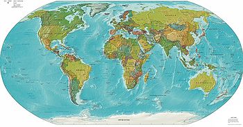
An atlas is a collection of maps, traditionally bound into book form, but now found in multimedia formats. As well as geographic features and political boundaries, many often feature geopolitical, social, religious and economic statistics. The first book that could be called an atlas was constructed from the calculations of Claudius Ptolemy, a Greek geographer working in Alexandria circa A.D. 150. The first edition was published in Bologna in 1477 and was illustrated with a set of 27 maps, though scholars say that it is not known whether the printed maps were engraved versions of original maps made by Ptolemy, or whether they were constructed by medieval Greek scholars from Ptolemy's text. The origin of the term atlas is a common source of misconception, perhaps because two different mythical figures named 'Atlas' are associated with mapmaking. King Atlas, a mythical King of Mauretania, was, according to legend, a wise philosopher, mathematician and astronomer who supposedly made the first celestial globe. However, the more widely known Atlas is a figure from Greek mythology. More about Atlases...
{{{title}}}The page "بوابة:أطلس/Selected picture/9" does not exist. {{{title}}}A compass rose is a figure displaying the orientation of the cardinal directions, north, south, east and west on a map or nautical chart. It is also the term for the graduated markings found on the traditional magnetic compass. Today the use and idea of a compass rose is found on or featured in almost all navigation systems, including nautical charts, NDB and VOR systems, some GPS sets and similar. The "rose" term arises from the fairly ornate figures used with early compasses. A fleur-de-lis figure, evolved from the initial T in the north wind's name Tramontane, is sometimes used to indicate the north direction. Early roses were depicted with 12 points at 30° each, as was favored by the Romans. In the Middle Ages map makers moved to the 16-point rose complaining that sailors did not have the education to understand the previous design. The earliest 32-point compass rose was developed by Arab navigators during the Middle Ages. تحرير Related portals
{{{title}}}The page "بوابة:أطلس/Selected quote/14" does not exist. تحرير Topics
تحرير Things you can do
تحرير Related categories
تحرير Associated Wikimedia
|


